Slideshow · News
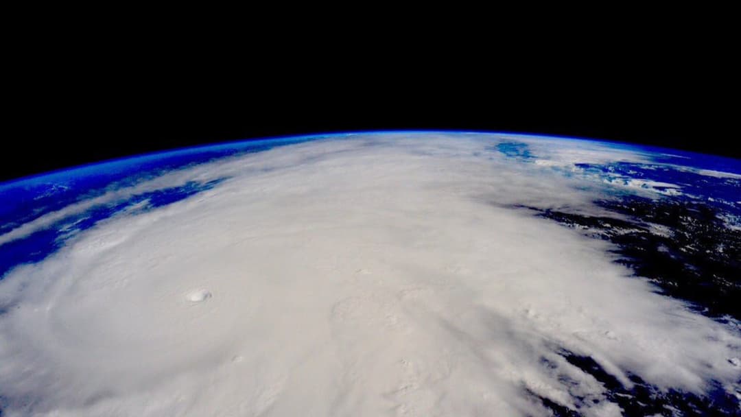
The Most Powerful Storms Ever Recorded, Ranked
We rank the 20 most intense hurricanes and super typhoons in meteorological history by their peak sustained wind speeds—culminating in the 215 mph record-holder.
By Most Viral Today
21 Oct 2026

Inside The 200+ MPH Megastorms That Redefined Atmospheric Science 
20. Hurricane Polo (September 2026) — 180 Mph 
19. Hurricane Milton (7 October 2024) — 180 Mph 
18. Hurricane Irma (6 September 2017) — 180 Mph - AdvertisementSwipe or tap ▶ to continue countdown

17. Hurricane Rita (21 September 2005) — 180 Mph 
16. Hurricane Dorian (1 September 2019) — 185 Mph 
15. Hurricane Gilbert (13 September 1988) — 185 Mph 
14. Hurricane Wilma (19 October 2005) — 185 Mph - AdvertisementSwipe or tap ▶ to continue countdown

13. Typhoon Megi (17 October 2010) — 185 Mph 
12. Typhoon Joan (29 August 1959) — 185 Mph 
11. Typhoon Vera (21 September 1959) — 190 Mph 
10. Typhoon Louise (18 November 1964) — 190 Mph - AdvertisementSwipe or tap ▶ to continue countdown

9. Hurricane Melissa (August 2025) — 190 Mph 
8. Hurricane Allen (7 August 1980) — 190 Mph 
7. Typhoon Tip (12 October 1979) — 190 Mph 
6. Typhoon Surigae (17 April 2021) — 195 Mph - AdvertisementSwipe or tap ▶ to continue countdown

5. Typhoon Goni (31 October 2020) — 195 Mph 
4. Typhoon Meranti (13 September 2016) — 195 Mph 
3. Typhoon Haiyan (8 November 2013) — 195 Mph 
2. Typhoon Nancy (12 September 1961) — 213 Mph - AdvertisementSwipe or tap ▶ to continue countdown

1. Hurricane Patricia (23 October 2015) — 215 Mph - Advertisement🔥 UP NEXT IN THIS SERIES◫ 22 Slides

Massive fire engulfs residential building in Nalasopara
Bright orange flames rage through windows as firefighters struggle to control the blaze in the Mumbai suburb.
Earth's oceans occasionally fuel tropical cyclones so intense they push the physical limits of the atmosphere. Ranked by peak sustained winds from 180 mph to 215 mph, here are the most powerful storms ever recorded.
Swipe or tap ▶ to begin the countdown
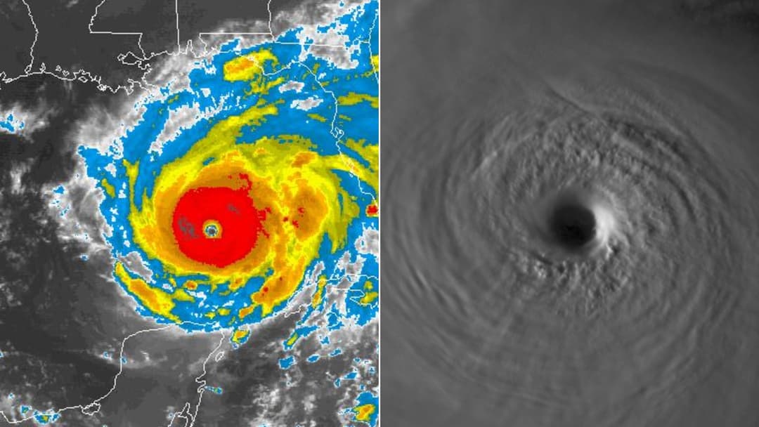
©Wikimedia / NOAA Environmental Visualization Lab & CSU CIRA
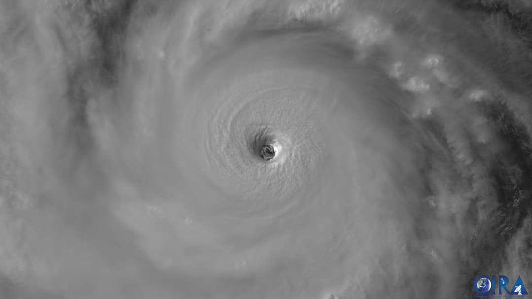
20. Hurricane Polo (September 2026) — 180 Mph
Forming in September 2026 over anomalously warm waters, Hurricane Polo underwent explosive rapid intensification into a 180 mph Category 5 monster. Satellite passes revealed a razor-sharp pinhole eye surrounded by deep convective towers before eyewall replacement cycles began.
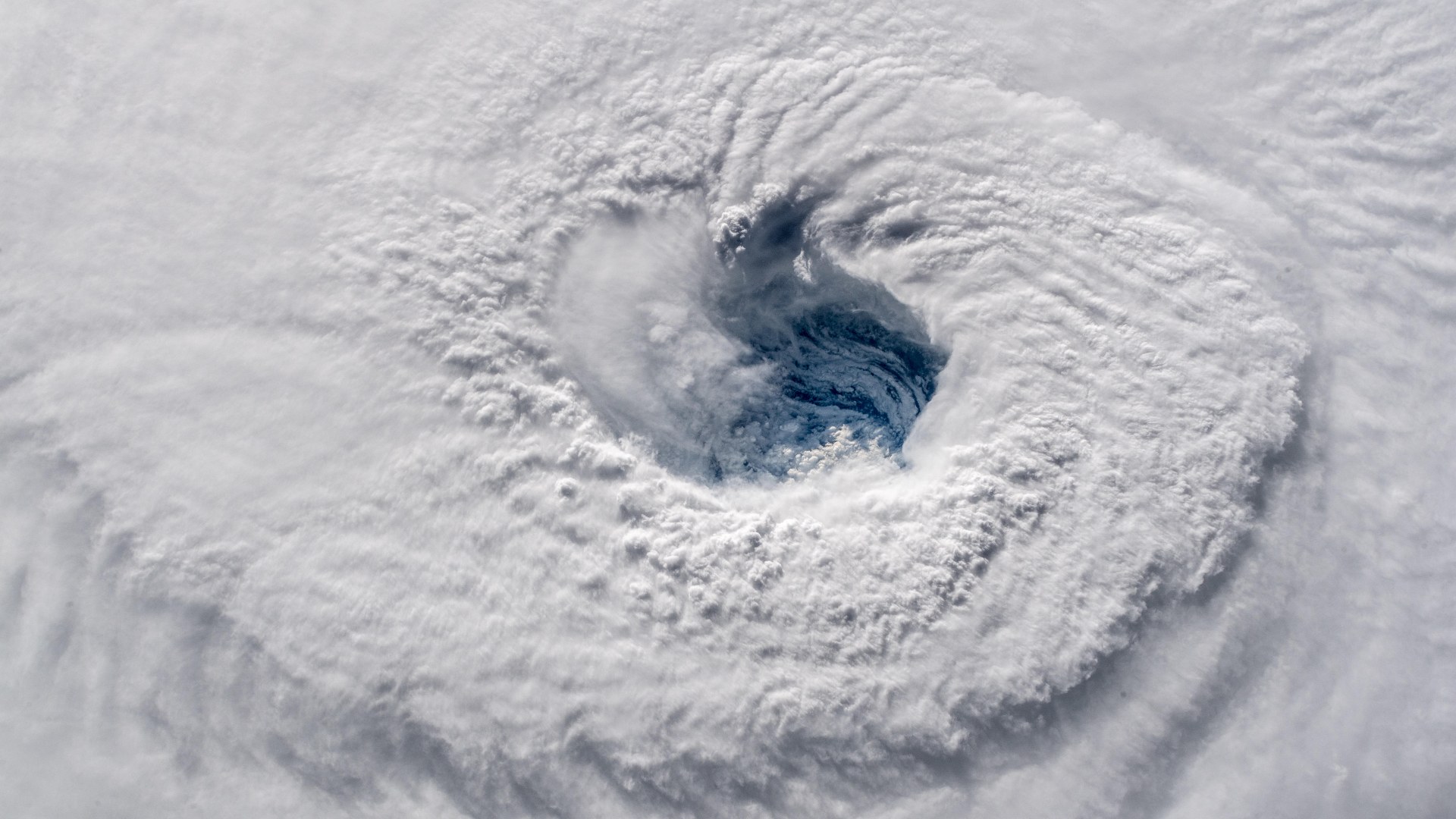
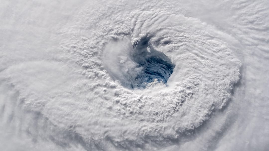
©Wikimedia / Alexander Gerst, ESA
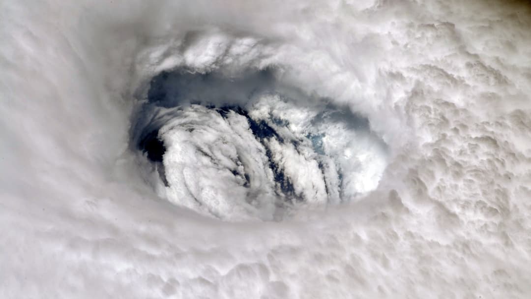
19. Hurricane Milton (7 October 2024) — 180 Mph
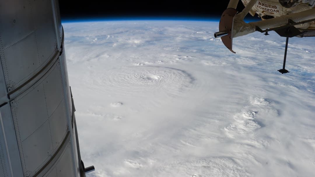
In October 2024, Hurricane Milton stunned meteorologists by intensifying from a tropical depression to a 180 mph Category 5 hurricane in the southern Gulf of Mexico in under 48 hours. Its central pressure plunged to 897 mbar, making it one of the most intense Atlantic storms on record.
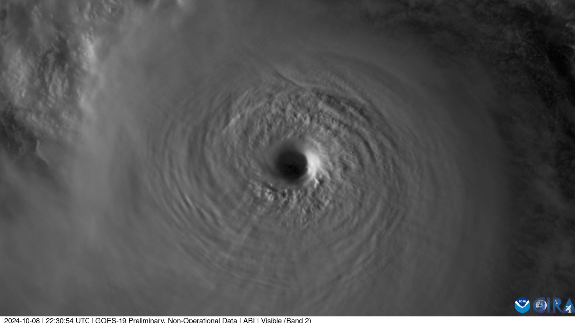
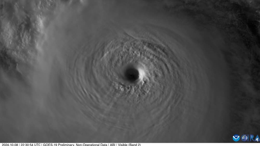
©Wikimedia / CSU CIRA & NOAA GOES-19
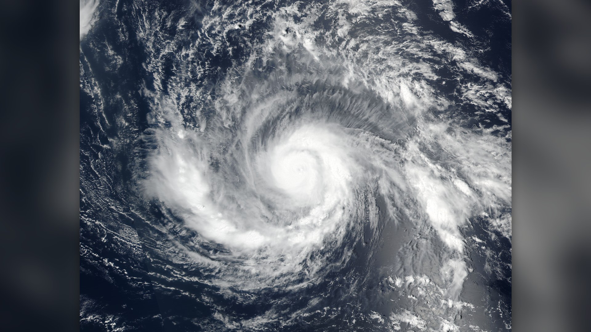
18. Hurricane Irma (6 September 2017) — 180 Mph
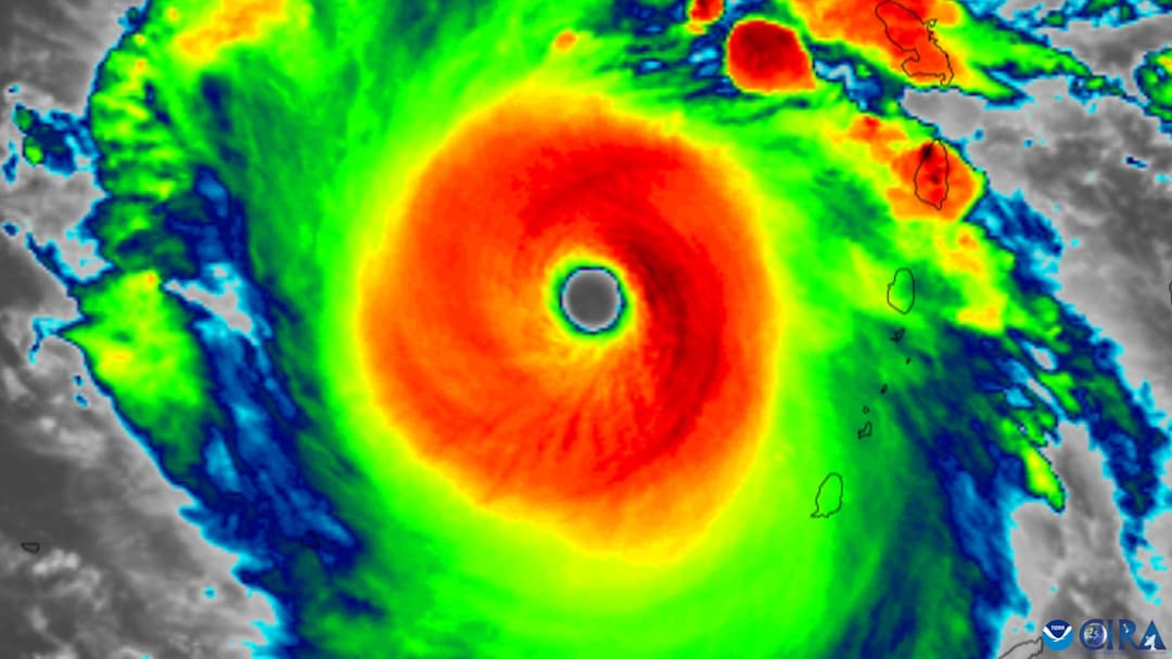
Peaking on September 6, 2017, Hurricane Irma reached sustained winds of 180 mph and maintained that extreme intensity for 37 hours—the longest continuous stretch of 180+ mph winds ever tracked by satellite. It devastated Barbuda and Saint Martin before striking Cuba and Florida.
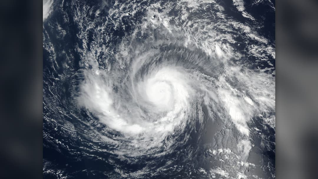
©Wikimedia / Suomi NPP VIIRS Team
Advertisement
Swipe or tap ▶ to resume the countdown.
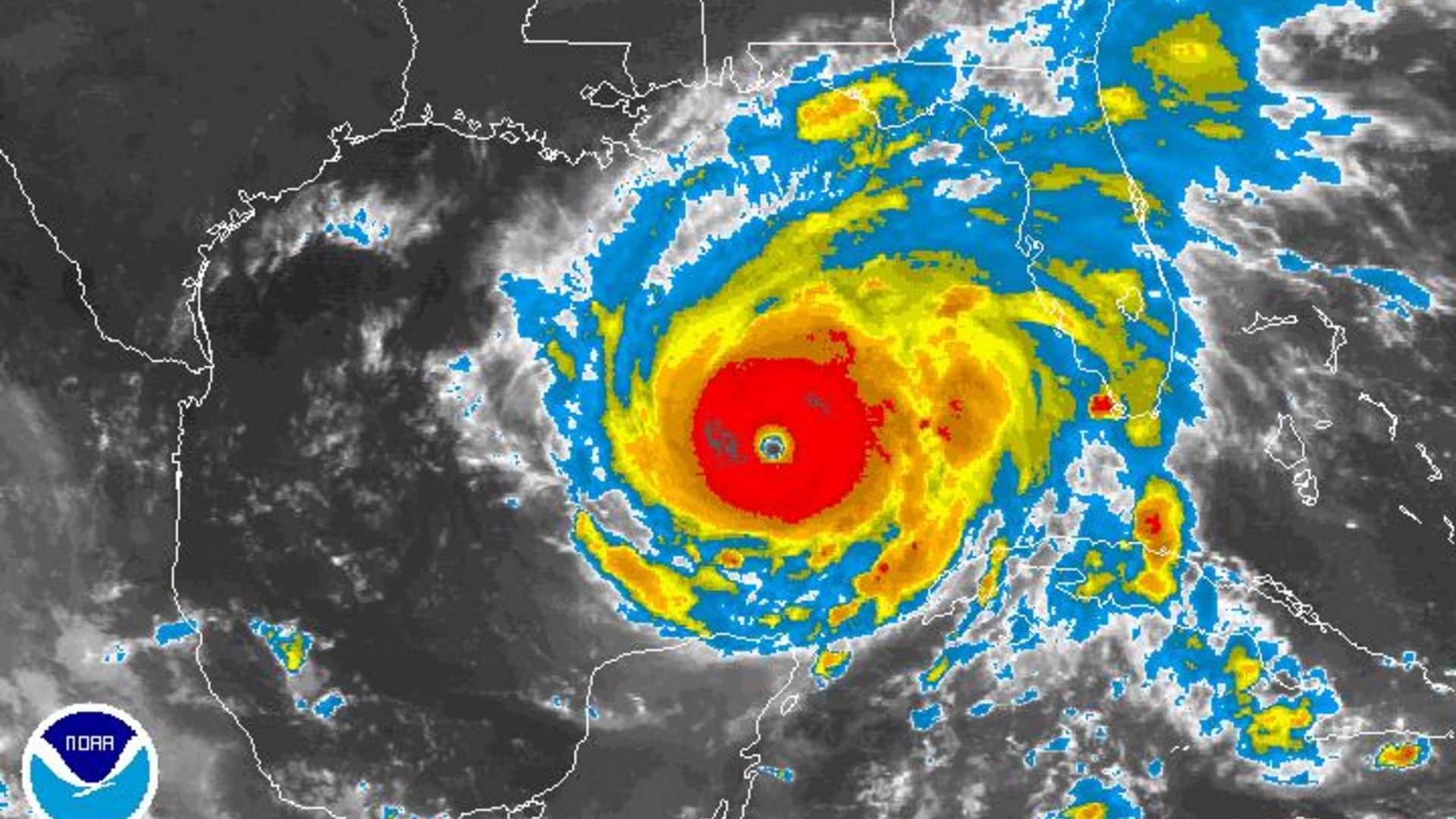
17. Hurricane Rita (21 September 2005) — 180 Mph
Just three weeks after Hurricane Katrina in September 2005, Hurricane Rita supercharged over the warm Loop Current in the Gulf of Mexico. On September 21, it reached peak winds of 180 mph and a central pressure of 895 mbar, triggering one of the largest coastal evacuations in U.S. history.
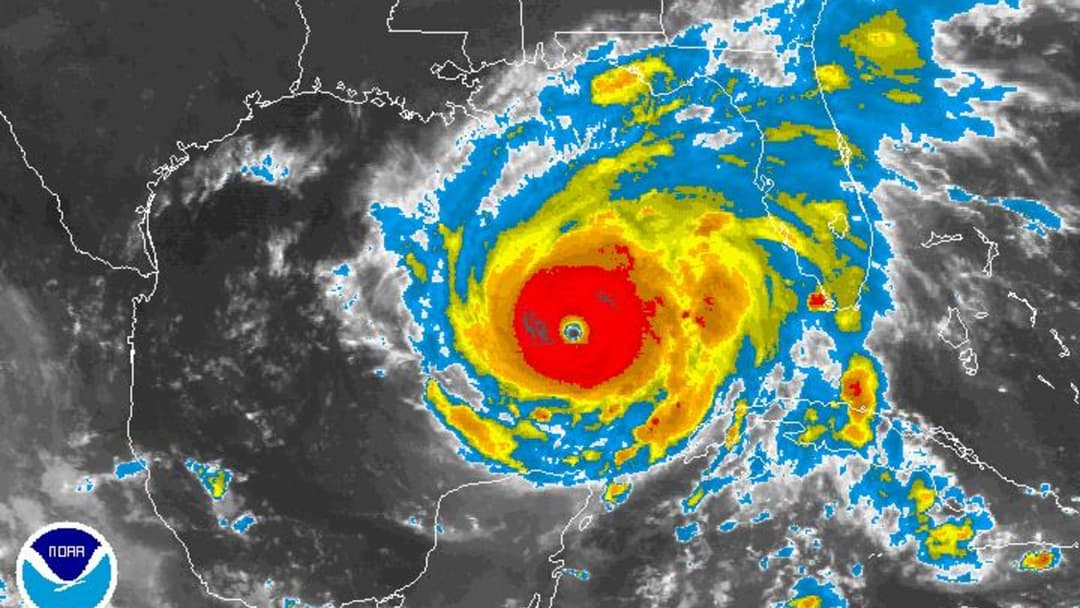
©Wikimedia / NOAA Environmental Visualization Lab
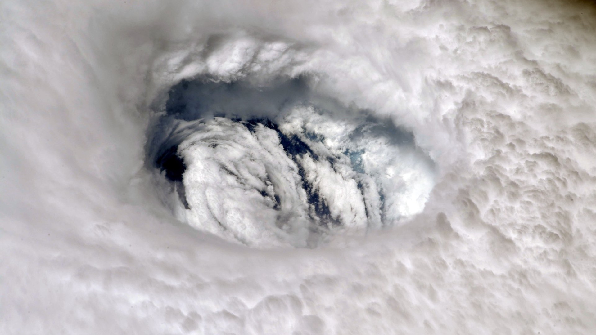
16. Hurricane Dorian (1 September 2019) — 185 Mph
On September 1, 2019, Hurricane Dorian slammed into Elbow Cay in the Abaco Islands with sustained winds of 185 mph, tying the record for the strongest landfalling Atlantic hurricane. Its steering currents then collapsed, causing the catastrophic eyewall to stall over Grand Bahama.
©Wikimedia / Cayobo & NOAA Satellites
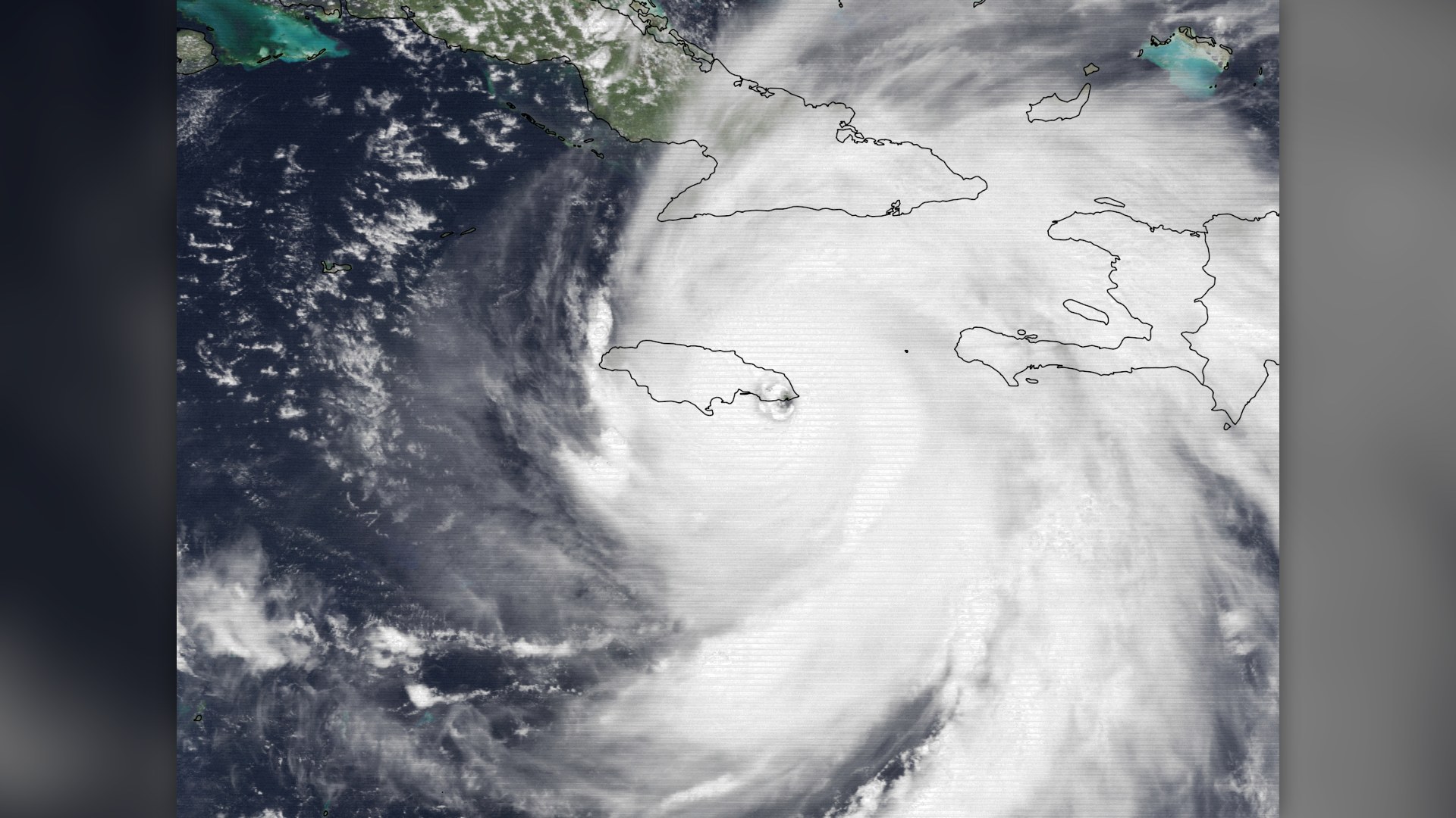
15. Hurricane Gilbert (13 September 1988) — 185 Mph
After raking Jamaica from end to end, Hurricane Gilbert exploded in the northwestern Caribbean on September 13, 1988, reaching 185 mph winds and an atmospheric pressure of 888 mbar. It later struck Mexico's Yucatan Peninsula as a fierce Category 5 storm.
©Wikimedia / NOAA GOES-7 Archive
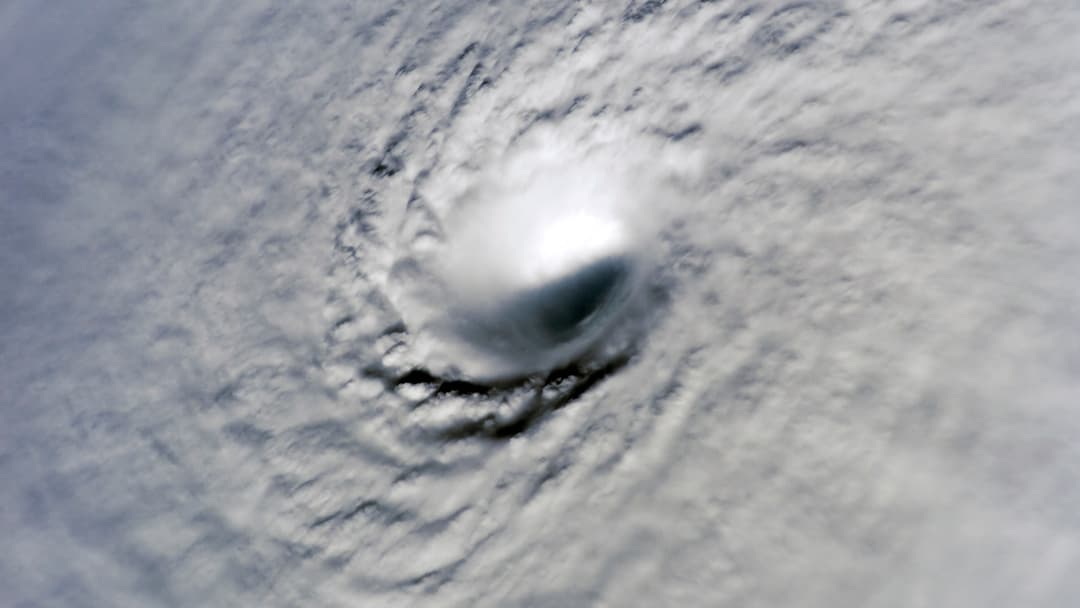
14. Hurricane Wilma (19 October 2005) — 185 Mph
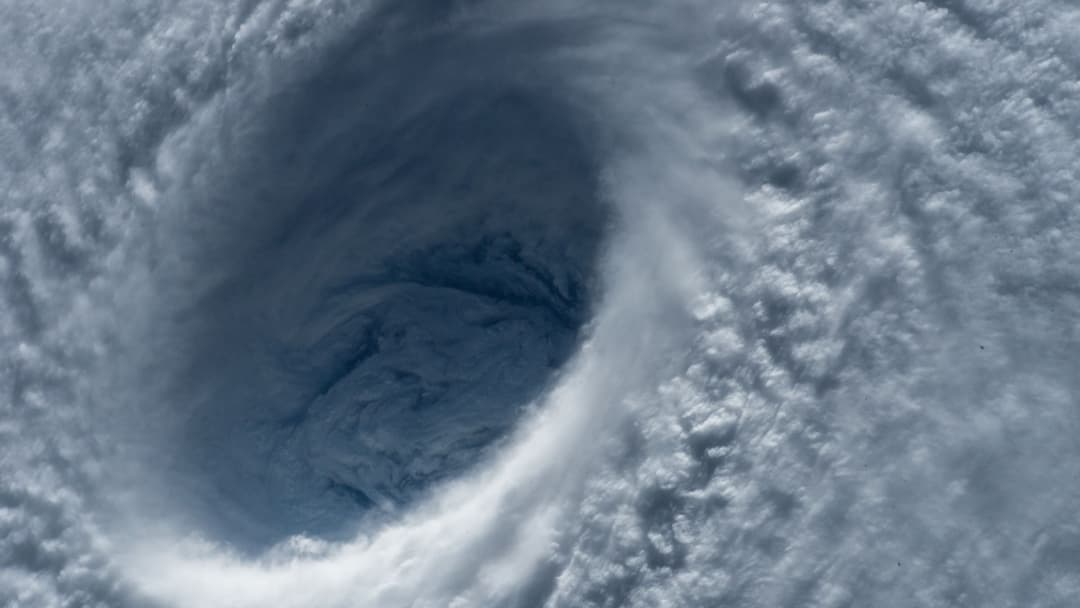
On October 19, 2005, Hurricane Wilma intensified from a 70 mph tropical storm to a 185 mph Category 5 hurricane in just 24 hours. Featuring a microscopic two-mile-wide pinhole eye, its central pressure dropped to 882 mbar—still the lowest ever measured in the Atlantic basin.
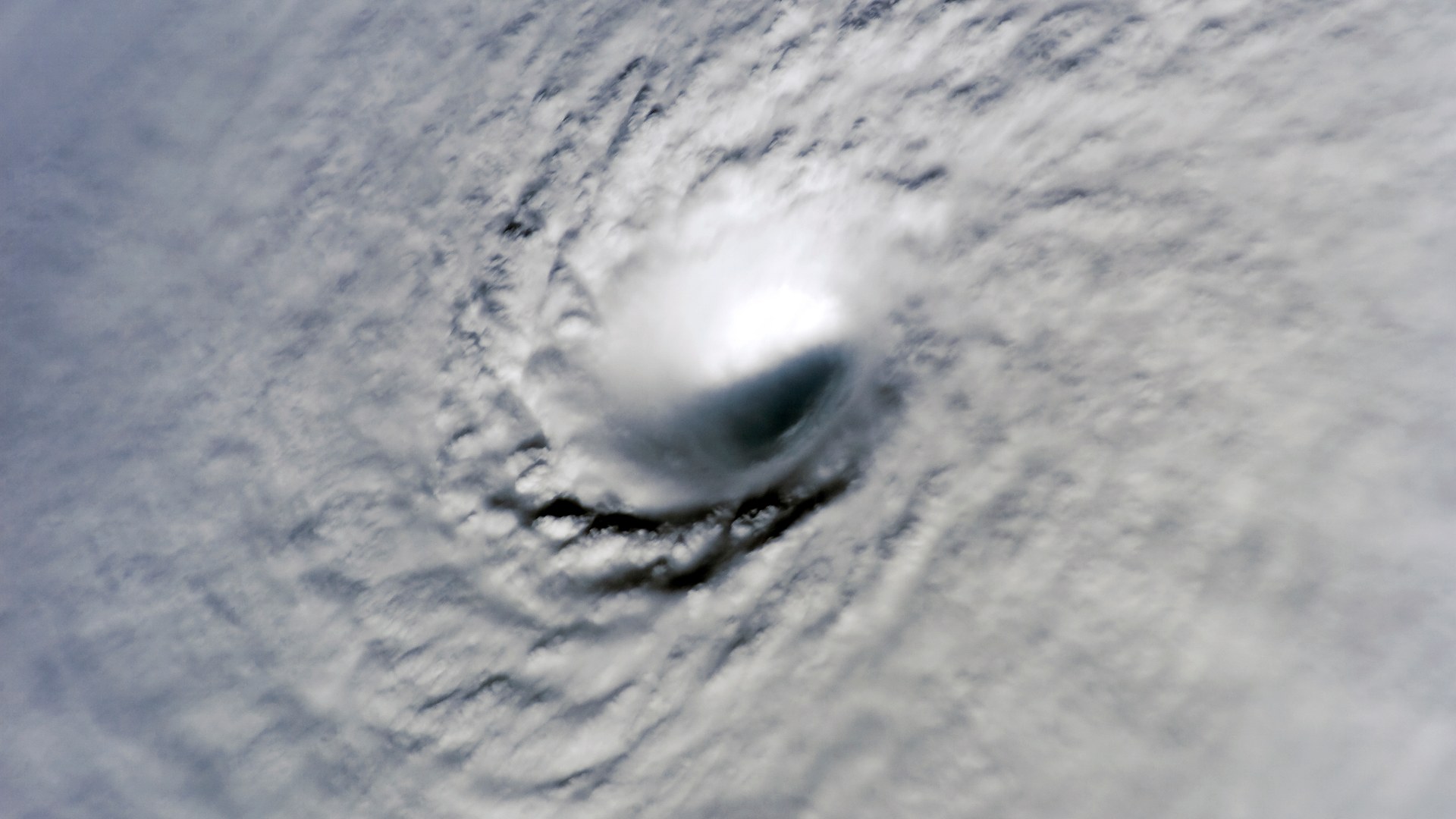
©Wikimedia / ISS Expedition 12 Crew
Advertisement
Swipe or tap ▶ to resume the countdown.
13. Typhoon Megi (17 October 2010) — 185 Mph
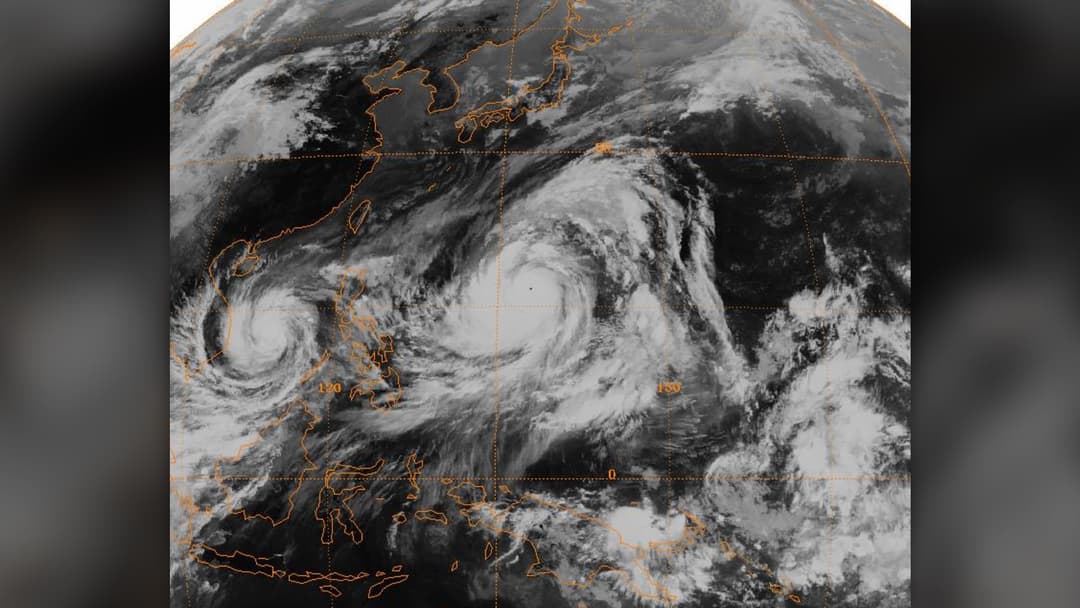
Known locally as Super Typhoon Juan, Typhoon Megi reached peak 1-minute sustained winds of 185 mph and a barometric pressure of 885 mbar on October 17, 2010. Aircraft reconnaissance measured extreme surface turbulence just hours before the storm struck northern Luzon.
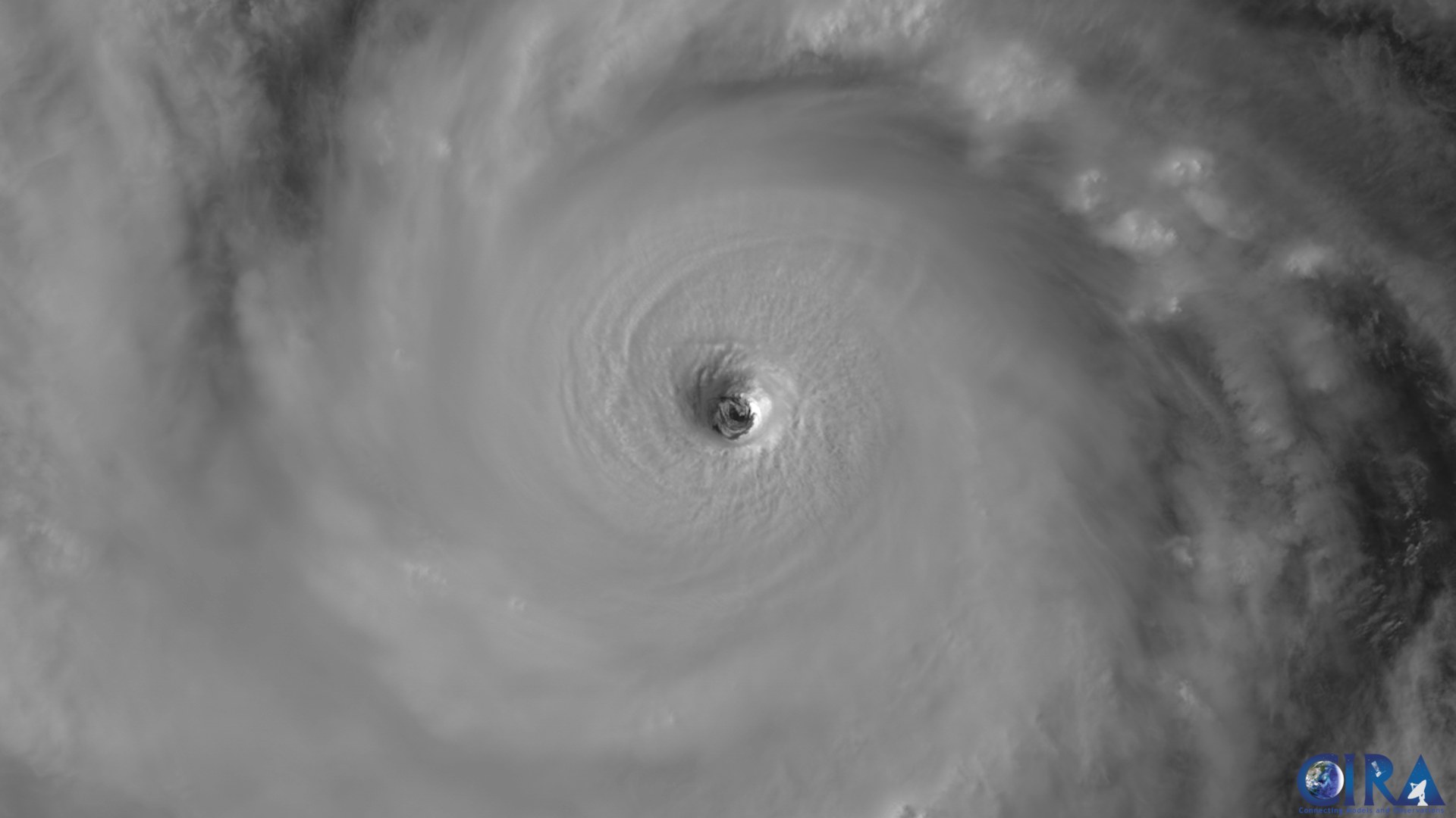
©Wikimedia / CSU CIRA & JMA Himawari
12. Typhoon Joan (29 August 1959) — 185 Mph
Peaking on August 29, 1959, Typhoon Joan generated 1-minute sustained winds of 185 mph and a central pressure of 885 mbar across the Philippine Sea. Still retaining Category 5 intensity at landfall, it crossed central Taiwan and eastern China with devastating storm surge.
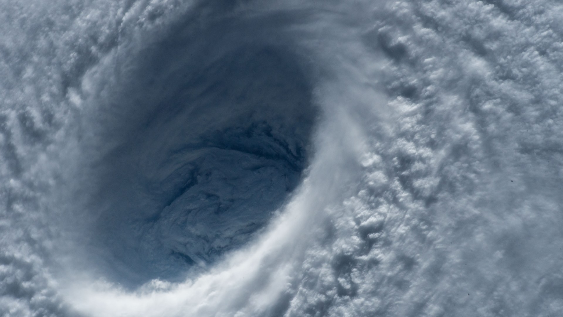
©Wikimedia / ISS Expedition 43 Crew
11. Typhoon Vera (21 September 1959) — 190 Mph
Also known as the Isewan Typhoon, Typhoon Vera reached peak sustained winds of 190 mph on September 21, 1959. Days later, it slammed into Honshu around Ise Bay, driving a catastrophic storm surge that breached coastal seawalls, flooded Nagoya, and claimed over 5,000 lives.

©Wikimedia / Disaster Prevention Research Institute
10. Typhoon Louise (18 November 1964) — 190 Mph
Also tracked as Typhoon Mading, Typhoon Louise exploded into a 190 mph super typhoon on November 18, 1964. Reconnaissance crews recorded a central pressure of 914 mbar and ferocious eyewall winds before the storm tore through the central Philippine archipelago.
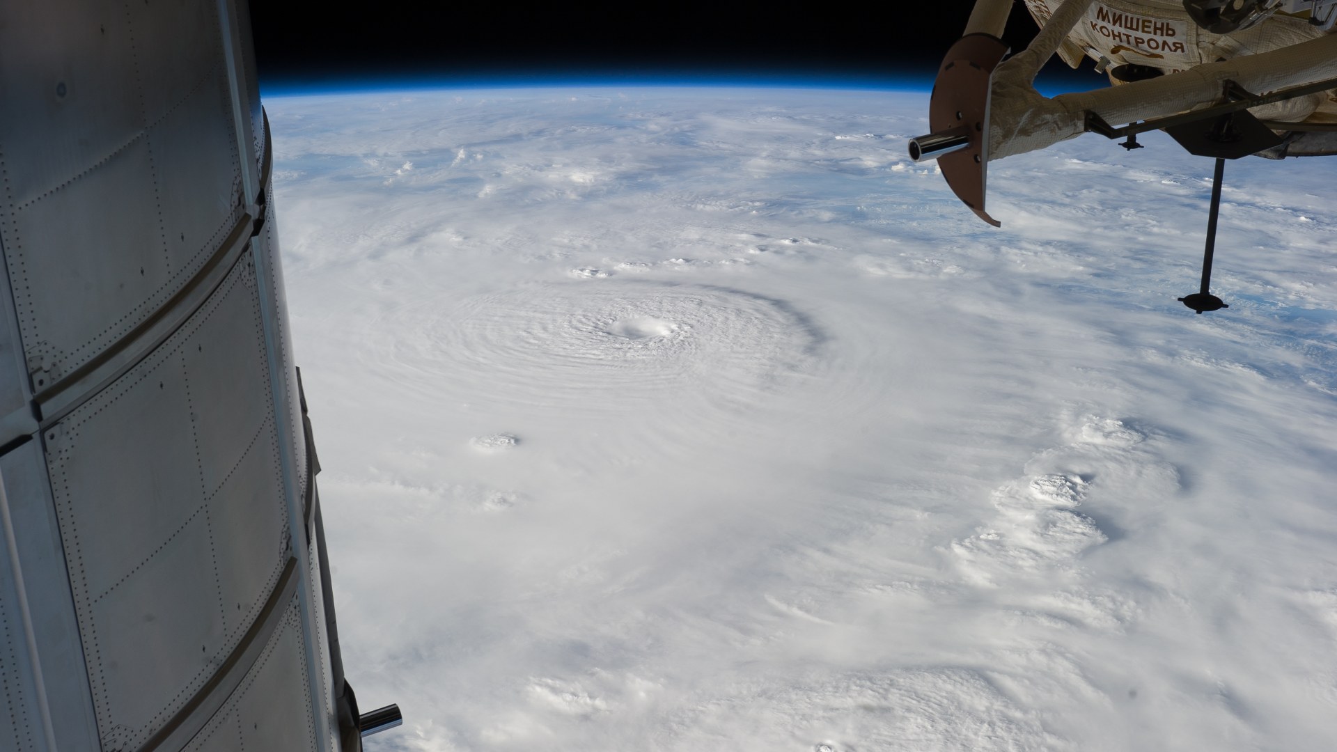
©Wikimedia / ISS Expedition 34 Crew
Advertisement
Swipe or tap ▶ to resume the countdown.
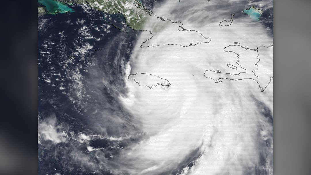
9. Hurricane Melissa (August 2025) — 190 Mph
In August 2025, Hurricane Melissa tapped into record oceanic heat content to reach peak 1-minute sustained winds of 190 mph. With a razor-sharp symmetrical eyewall and frequent lightning bursts in its core, Melissa tied Hurricane Allen among the fiercest Atlantic cyclones ever recorded.
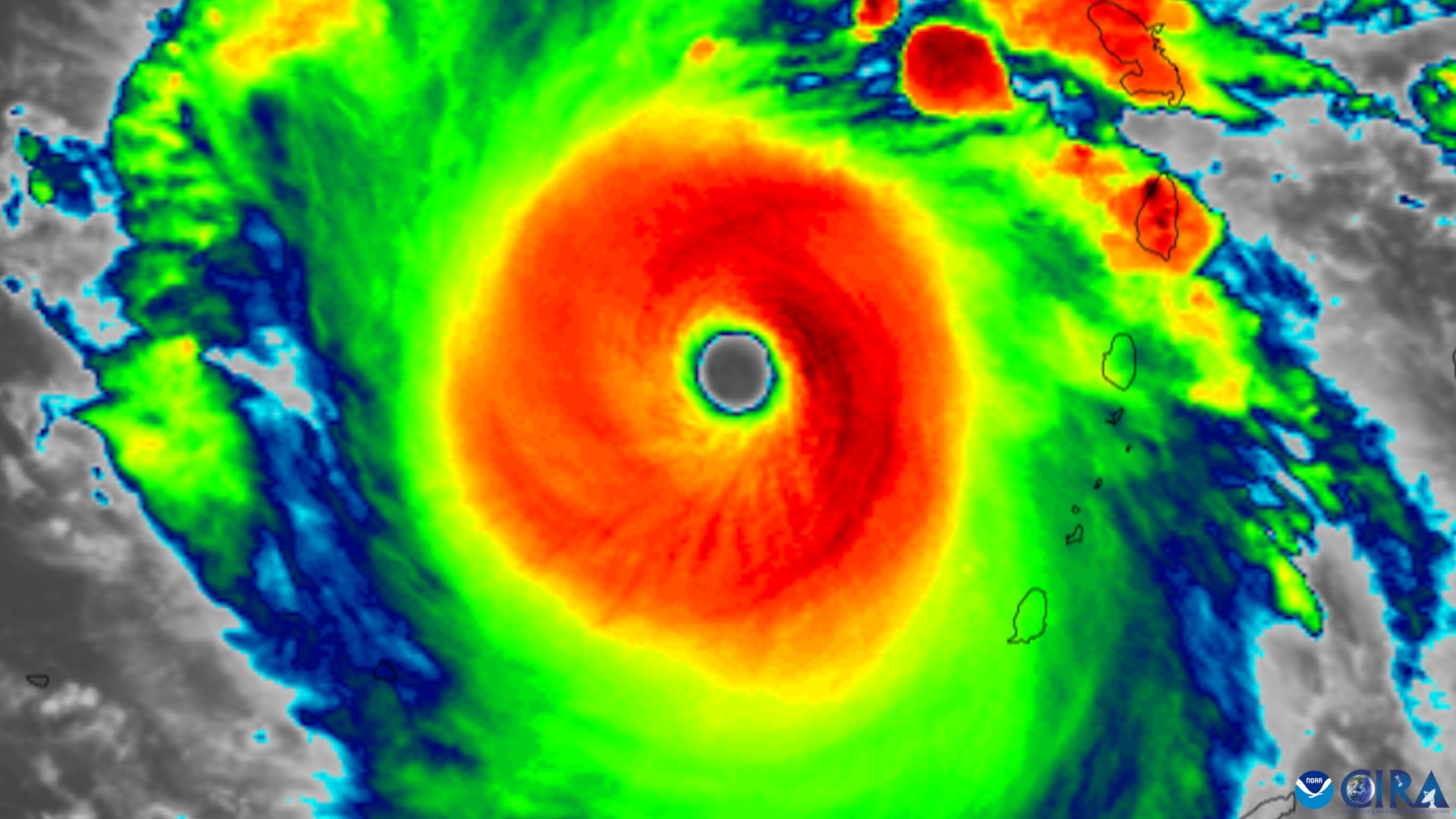
©Wikimedia / CSU CIRA & NOAA GOES-16
8. Hurricane Allen (7 August 1980) — 190 Mph
Hurricane Allen achieved Category 5 status three separate times during its trek across the Caribbean and Gulf of Mexico in August 1980. On August 7, reconnaissance aircraft measured peak sustained winds of 190 mph and an 899 mbar pressure as it passed through the Yucatan Channel.

©Wikimedia / Jay Phagan
7. Typhoon Tip (12 October 1979) — 190 Mph
On October 12, 1979, Super Typhoon Tip reached 190 mph winds while setting two all-time world records that still stand: the lowest sea-level pressure ever measured on Earth (870 mbar) and the largest wind diameter in history, stretching 1,380 miles—nearly half the width of the United States.
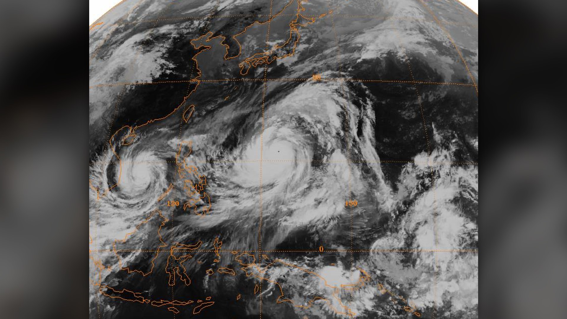
©Wikimedia / JMA GMS-1 Satellite Archive
6. Typhoon Surigae (17 April 2021) — 195 Mph
Known in the Philippines as Super Typhoon Bising, Typhoon Surigae rapidly intensified into a 195 mph behemoth on April 17, 2021, with a central pressure of 882 mbar. It remains the strongest tropical cyclone ever recorded before the month of May in the Northern Hemisphere.
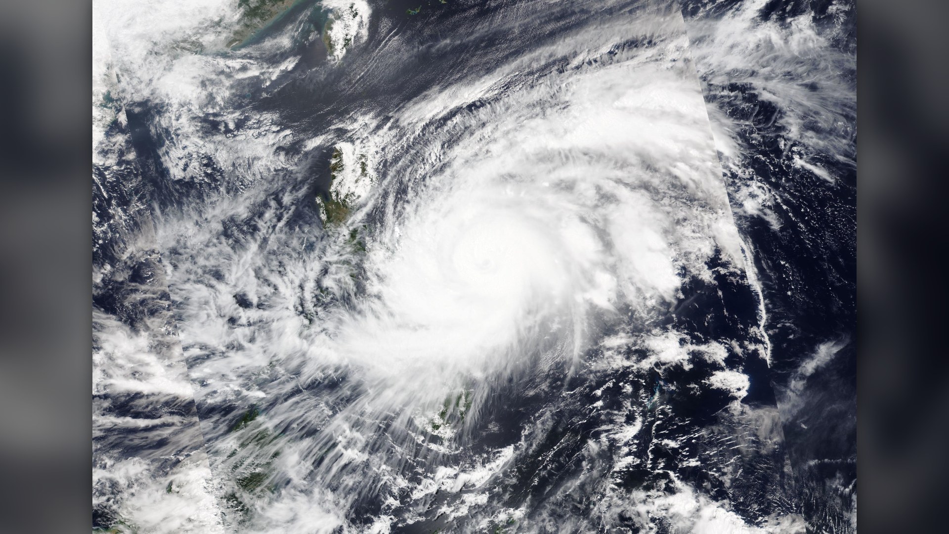
©Wikimedia / JMA Himawari-8 Satellite
Advertisement
Swipe or tap ▶ to resume the countdown.
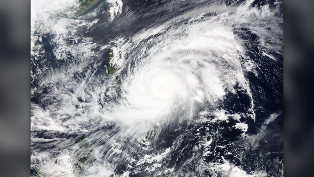
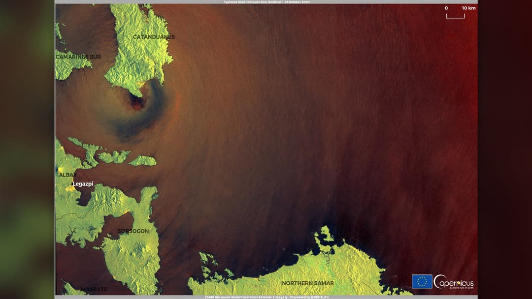
5. Typhoon Goni (31 October 2020) — 195 Mph
Known locally as Super Typhoon Rolly, Typhoon Goni peaked at 195 mph sustained winds on October 31, 2020, just as its core made direct landfall on Catanduanes Island in the Philippines. That strike made Goni the most intense landfalling tropical cyclone in recorded history.
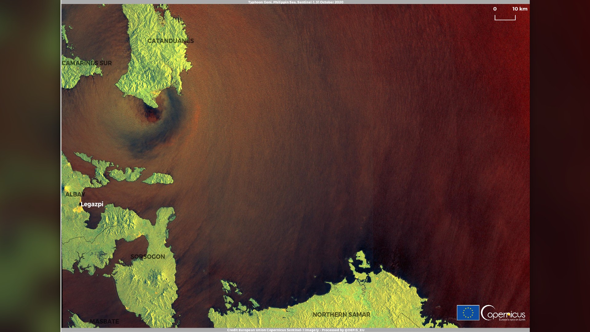
©Wikimedia / Copernicus Sentinel-1 Team
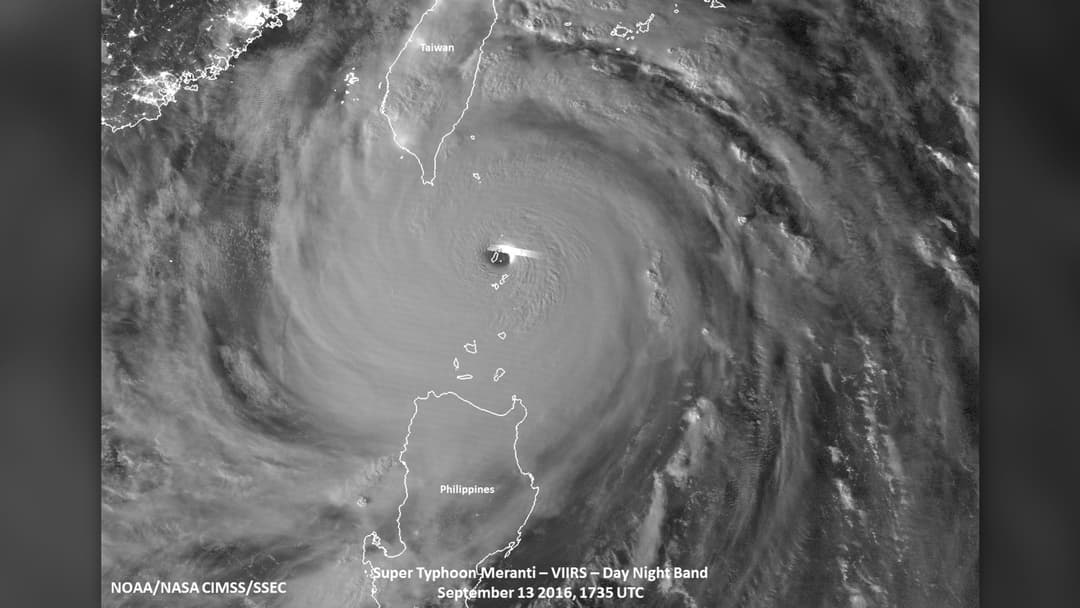
4. Typhoon Meranti (13 September 2016) — 195 Mph
Tracking through the Luzon Strait on September 13, 2016, Super Typhoon Meranti reached peak 1-minute sustained winds of 195 mph and an 890 mbar pressure. Its eye passed directly over the tiny island of Itbayat at peak intensity, leaving inhabitants inside an eerie calm surrounded by nearly 200 mph winds.
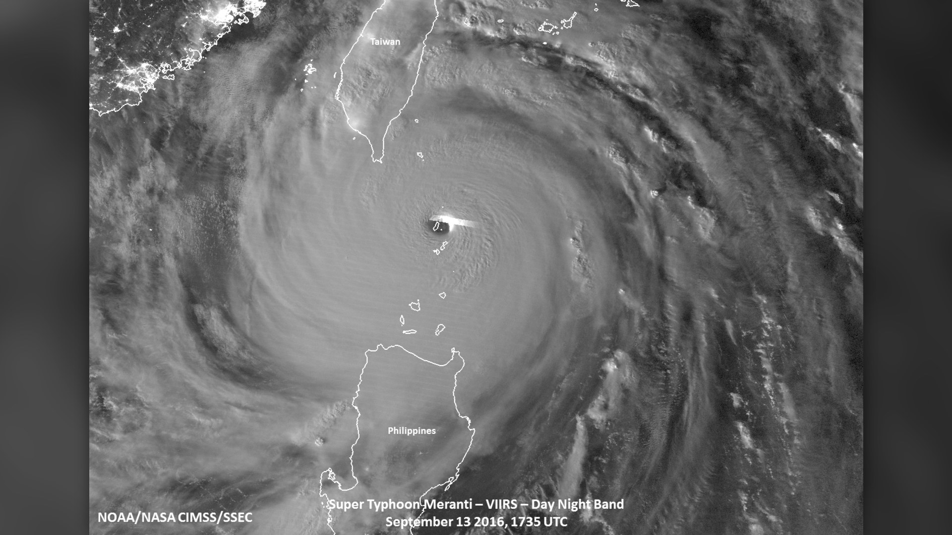
©Wikimedia / CIMSS Suomi NPP Satellite
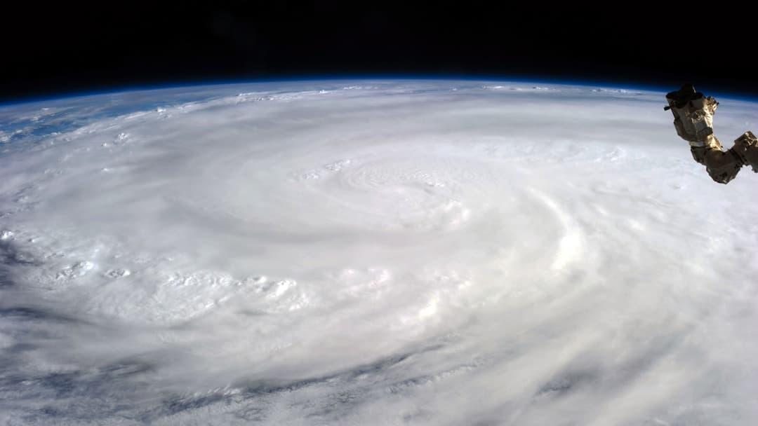
3. Typhoon Haiyan (8 November 2013) — 195 Mph
Known in the Philippines as Super Typhoon Yolanda, Typhoon Haiyan reached 195 mph winds on November 8, 2013, exhibiting one of the most symmetrical satellite signatures ever observed. It slammed into Guiuan and Tacloban with catastrophic storm surge, claiming more than 6,300 lives.
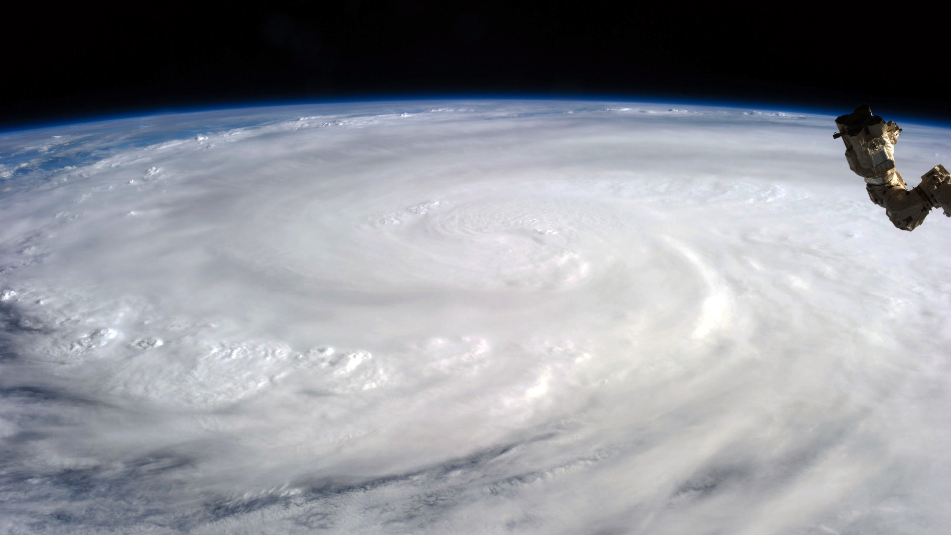
©Wikimedia / Karen Nyberg, ISS Expedition 37
2. Typhoon Nancy (12 September 1961) — 213 Mph
For 54 years, Super Typhoon Nancy held the title for the highest wind speed ever attributed to a tropical cyclone. On September 12, 1961, U.S. Navy reconnaissance aircraft flying into its eyewall estimated 1-minute sustained winds at 213 mph before the storm curved northward toward Okinawa and Osaka.

©Wikimedia / Air Force Reserve Hurricane Hunters
Advertisement
Swipe or tap ▶ to resume the countdown.
1. Hurricane Patricia (23 October 2015) — 215 Mph
In a feat of atmospheric intensification that defied computer models, Hurricane Patricia rocketed from a tropical storm to an all-time record 215 mph Category 5 monster in just 24 hours on October 23, 2015. Hurricane Hunters measured a Western Hemisphere record pressure of 872 mbar inside its eight-mile-wide eye.
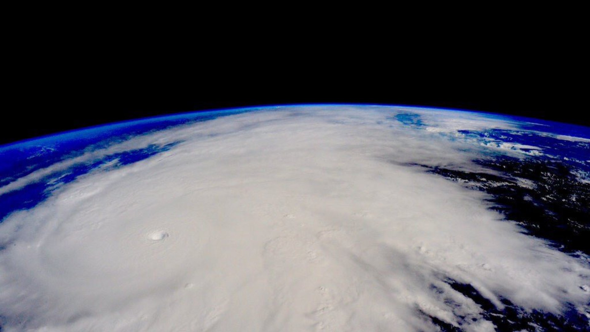
©Wikimedia / Scott Kelly, ISS Expedition 45
Advertisement
You've reached the end of the story. Thanks for reading!
Massive fire engulfs residential building in Nalasopara
Bright orange flames rage through windows as firefighters struggle to control the blaze in the Mumbai suburb.
All 20 Entries in this Story
20. Hurricane Polo (September 2026) — 180 Mph
Forming in September 2026 over anomalously warm waters, Hurricane Polo underwent explosive rapid intensification into a 180 mph Category 5 monster. Satellite passes revealed a razor-sharp pinhole eye surrounded by deep convective towers before eyewall replacement cycles began.

19. Hurricane Milton (7 October 2024) — 180 Mph
In October 2024, Hurricane Milton stunned meteorologists by intensifying from a tropical depression to a 180 mph Category 5 hurricane in the southern Gulf of Mexico in under 48 hours. Its central pressure plunged to 897 mbar, making it one of the most intense Atlantic storms on record.

18. Hurricane Irma (6 September 2017) — 180 Mph
Peaking on September 6, 2017, Hurricane Irma reached sustained winds of 180 mph and maintained that extreme intensity for 37 hours—the longest continuous stretch of 180+ mph winds ever tracked by satellite. It devastated Barbuda and Saint Martin before striking Cuba and Florida.

17. Hurricane Rita (21 September 2005) — 180 Mph
Just three weeks after Hurricane Katrina in September 2005, Hurricane Rita supercharged over the warm Loop Current in the Gulf of Mexico. On September 21, it reached peak winds of 180 mph and a central pressure of 895 mbar, triggering one of the largest coastal evacuations in U.S. history.

16. Hurricane Dorian (1 September 2019) — 185 Mph
On September 1, 2019, Hurricane Dorian slammed into Elbow Cay in the Abaco Islands with sustained winds of 185 mph, tying the record for the strongest landfalling Atlantic hurricane. Its steering currents then collapsed, causing the catastrophic eyewall to stall over Grand Bahama.

15. Hurricane Gilbert (13 September 1988) — 185 Mph
After raking Jamaica from end to end, Hurricane Gilbert exploded in the northwestern Caribbean on September 13, 1988, reaching 185 mph winds and an atmospheric pressure of 888 mbar. It later struck Mexico's Yucatan Peninsula as a fierce Category 5 storm.

14. Hurricane Wilma (19 October 2005) — 185 Mph
On October 19, 2005, Hurricane Wilma intensified from a 70 mph tropical storm to a 185 mph Category 5 hurricane in just 24 hours. Featuring a microscopic two-mile-wide pinhole eye, its central pressure dropped to 882 mbar—still the lowest ever measured in the Atlantic basin.

13. Typhoon Megi (17 October 2010) — 185 Mph
Known locally as Super Typhoon Juan, Typhoon Megi reached peak 1-minute sustained winds of 185 mph and a barometric pressure of 885 mbar on October 17, 2010. Aircraft reconnaissance measured extreme surface turbulence just hours before the storm struck northern Luzon.

12. Typhoon Joan (29 August 1959) — 185 Mph
Peaking on August 29, 1959, Typhoon Joan generated 1-minute sustained winds of 185 mph and a central pressure of 885 mbar across the Philippine Sea. Still retaining Category 5 intensity at landfall, it crossed central Taiwan and eastern China with devastating storm surge.

11. Typhoon Vera (21 September 1959) — 190 Mph
Also known as the Isewan Typhoon, Typhoon Vera reached peak sustained winds of 190 mph on September 21, 1959. Days later, it slammed into Honshu around Ise Bay, driving a catastrophic storm surge that breached coastal seawalls, flooded Nagoya, and claimed over 5,000 lives.

10. Typhoon Louise (18 November 1964) — 190 Mph
Also tracked as Typhoon Mading, Typhoon Louise exploded into a 190 mph super typhoon on November 18, 1964. Reconnaissance crews recorded a central pressure of 914 mbar and ferocious eyewall winds before the storm tore through the central Philippine archipelago.

9. Hurricane Melissa (August 2025) — 190 Mph
In August 2025, Hurricane Melissa tapped into record oceanic heat content to reach peak 1-minute sustained winds of 190 mph. With a razor-sharp symmetrical eyewall and frequent lightning bursts in its core, Melissa tied Hurricane Allen among the fiercest Atlantic cyclones ever recorded.

8. Hurricane Allen (7 August 1980) — 190 Mph
Hurricane Allen achieved Category 5 status three separate times during its trek across the Caribbean and Gulf of Mexico in August 1980. On August 7, reconnaissance aircraft measured peak sustained winds of 190 mph and an 899 mbar pressure as it passed through the Yucatan Channel.

7. Typhoon Tip (12 October 1979) — 190 Mph
On October 12, 1979, Super Typhoon Tip reached 190 mph winds while setting two all-time world records that still stand: the lowest sea-level pressure ever measured on Earth (870 mbar) and the largest wind diameter in history, stretching 1,380 miles—nearly half the width of the United States.

6. Typhoon Surigae (17 April 2021) — 195 Mph
Known in the Philippines as Super Typhoon Bising, Typhoon Surigae rapidly intensified into a 195 mph behemoth on April 17, 2021, with a central pressure of 882 mbar. It remains the strongest tropical cyclone ever recorded before the month of May in the Northern Hemisphere.

5. Typhoon Goni (31 October 2020) — 195 Mph
Known locally as Super Typhoon Rolly, Typhoon Goni peaked at 195 mph sustained winds on October 31, 2020, just as its core made direct landfall on Catanduanes Island in the Philippines. That strike made Goni the most intense landfalling tropical cyclone in recorded history.

4. Typhoon Meranti (13 September 2016) — 195 Mph
Tracking through the Luzon Strait on September 13, 2016, Super Typhoon Meranti reached peak 1-minute sustained winds of 195 mph and an 890 mbar pressure. Its eye passed directly over the tiny island of Itbayat at peak intensity, leaving inhabitants inside an eerie calm surrounded by nearly 200 mph winds.

3. Typhoon Haiyan (8 November 2013) — 195 Mph
Known in the Philippines as Super Typhoon Yolanda, Typhoon Haiyan reached 195 mph winds on November 8, 2013, exhibiting one of the most symmetrical satellite signatures ever observed. It slammed into Guiuan and Tacloban with catastrophic storm surge, claiming more than 6,300 lives.

2. Typhoon Nancy (12 September 1961) — 213 Mph
For 54 years, Super Typhoon Nancy held the title for the highest wind speed ever attributed to a tropical cyclone. On September 12, 1961, U.S. Navy reconnaissance aircraft flying into its eyewall estimated 1-minute sustained winds at 213 mph before the storm curved northward toward Okinawa and Osaka.

1. Hurricane Patricia (23 October 2015) — 215 Mph
In a feat of atmospheric intensification that defied computer models, Hurricane Patricia rocketed from a tropical storm to an all-time record 215 mph Category 5 monster in just 24 hours on October 23, 2015. Hurricane Hunters measured a Western Hemisphere record pressure of 872 mbar inside its eight-mile-wide eye.