Slideshow · Travel
22 Cities and Towns Built Beside the World's Active Volcanoes
From Sicily and Iceland to Japan, Indonesia, and the Pacific Northwest, these 22 cities and towns stand on lava fields, caldera floors, and ash-swept slopes beside active volcanoes. Built using Smithsonian Global Volcanism Program records and USGS and INGV hazard data, each entry documents real eruptions.
By Most Viral Today
1 hour agoradar-lead:signal:aa0f26aa-500a-44da-9373-c77458dc2bb2

These 22 Towns and Cities Sit Directly in the Path of Active Volcanoes 
22. Rabaul, Papua New Guinea 
21. Shimabara, Japan 
20. Pasto, Colombia - AdvertisementSwipe or tap ▶ to continue countdown

19. Saint-Pierre, Martinique 
18. Pozzuoli, Italy 
17. Legazpi, Philippines 
16. Vestmannaeyjar, Iceland - AdvertisementSwipe or tap ▶ to continue countdown

15. Grindavik, Iceland 
14. Rotorua, New Zealand 
13. Antigua Guatemala, Guatemala 
12. Puebla, Mexico - AdvertisementSwipe or tap ▶ to continue countdown

11. Arequipa, Peru 
10. Quito, Ecuador 
9. San Salvador, El Salvador 
8. Yogyakarta, Indonesia - AdvertisementSwipe or tap ▶ to continue countdown

7. Manado, Indonesia 
6. Goma, DR Congo 
5. Kagoshima, Japan 
4. Hilo, Hawaii - AdvertisementSwipe or tap ▶ to continue countdown

3. Tacoma, Washington 
2. Catania, Italy 
1. Naples, Italy - Advertisement🔥 UP NEXT IN THIS SERIES◫ 26 Slides

25 Most Welcoming US States Ranked by Hospitality
Which American State Truly Treats Strangers Like Family
From Sicily and Iceland to Japan, Indonesia, and the Pacific Northwest, these 22 cities and towns stand on lava fields, caldera floors, and ash-swept slopes beside active volcanoes. Built using Smithsonian Global Volcanism Program records and USGS and INGV hazard data, each entry documents real eruptions.
Swipe or tap ▶ to begin the countdown
©Wikimedia / Giuseppe Milo from Lisbon, Portugal
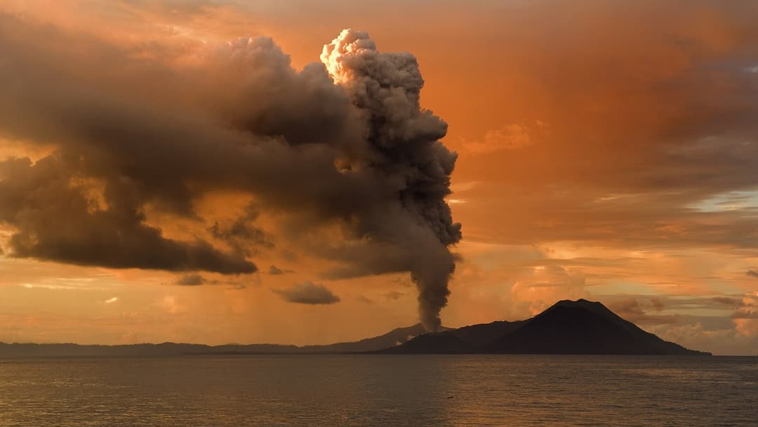
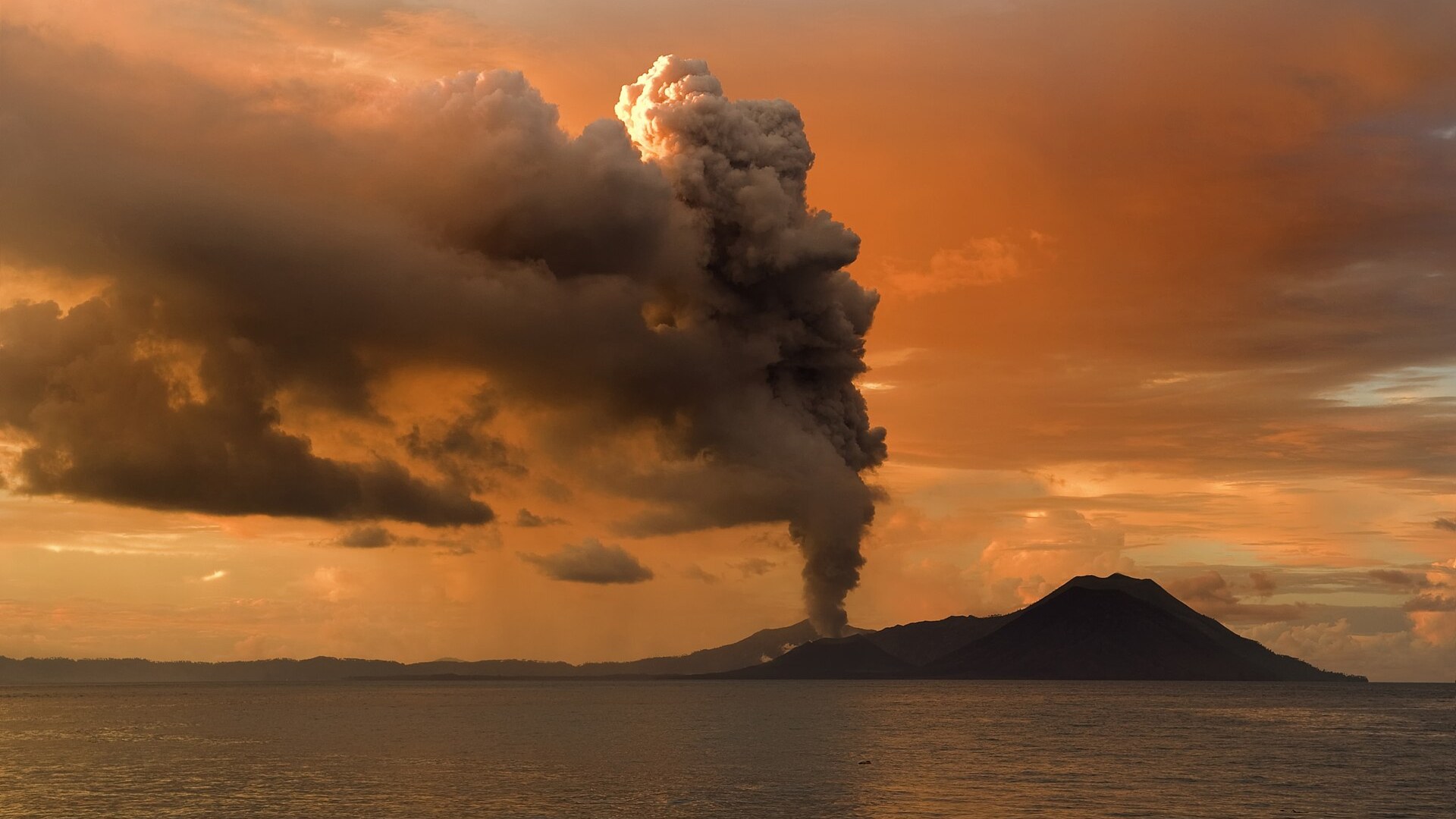
22. Rabaul, Papua New Guinea
Rabaul was built inside a flooded volcanic caldera on New Britain Island. On September 19, 1994, vents Tavurvur and Vulcan erupted together, collapsing roofs across the town under wet ash. Papua New Guinea moved the provincial capital to Kokopo, though Rabaul's deep harbor remains active.
©Wikimedia / Taro Taylor edit by Richard Bartz
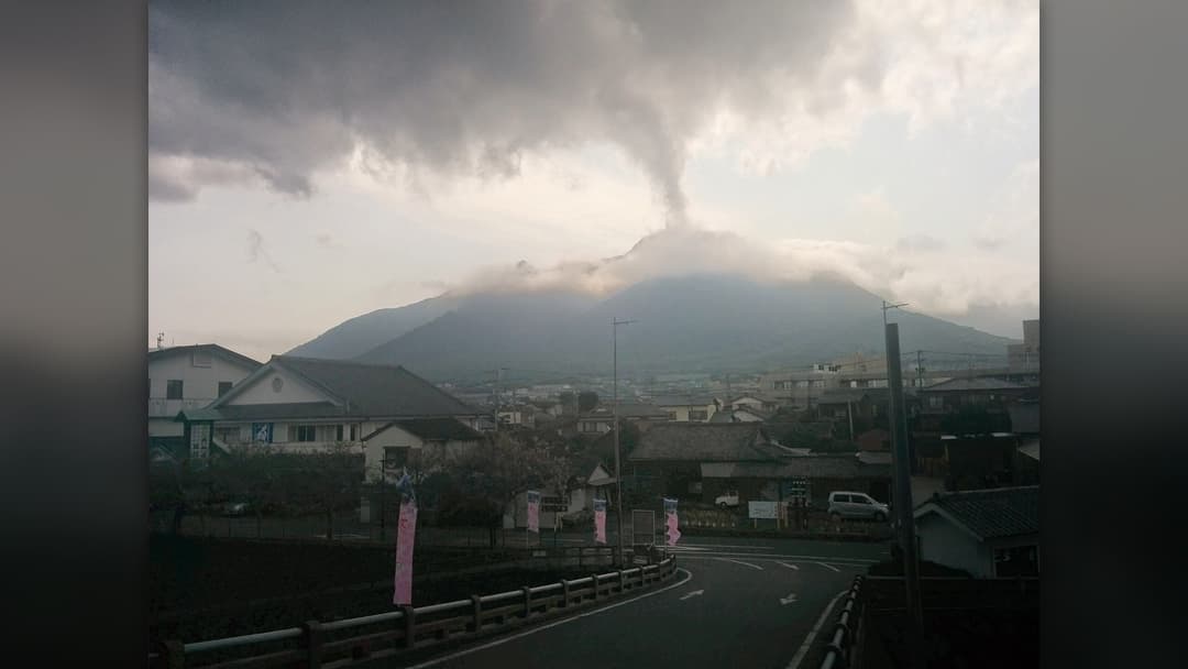
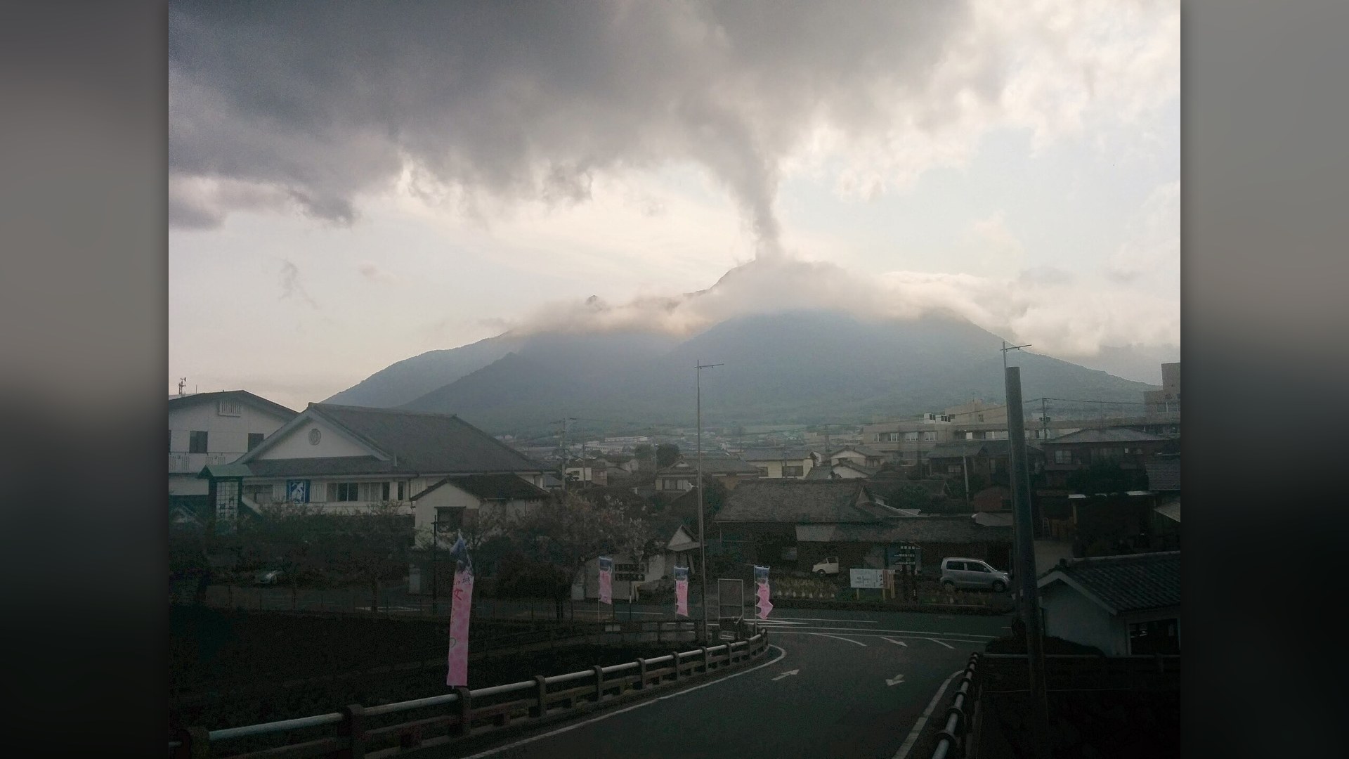
21. Shimabara, Japan
Shimabara sits on Kyushu's Shimabara Peninsula directly below the Mount Unzen volcanic complex. In 1792, an eruption and collapse of Mount Mayuyama triggered a deadly tsunami across the Ariake Sea. After June 1991 pyroclastic flows killed 43 people, engineers built check dams and evacuation channels.
©Wikimedia / NevinThompson
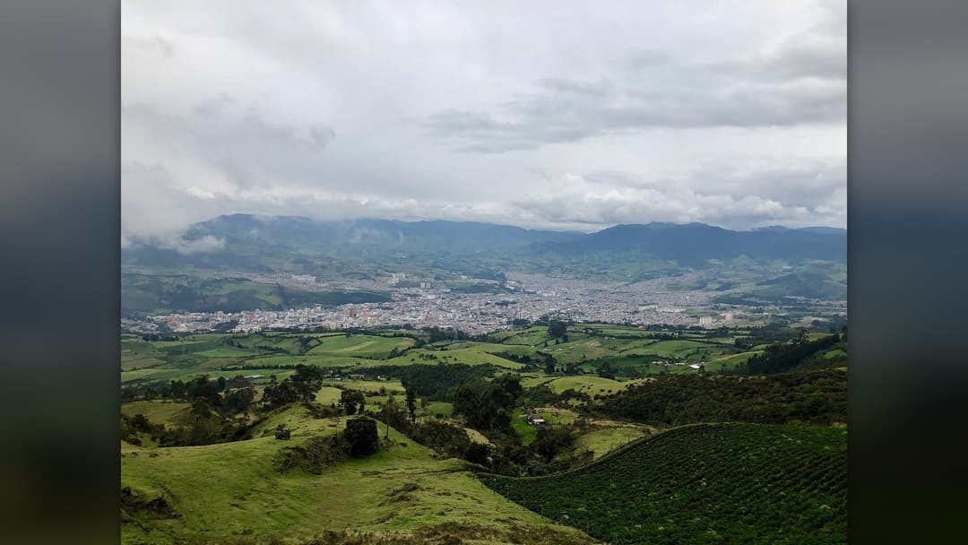
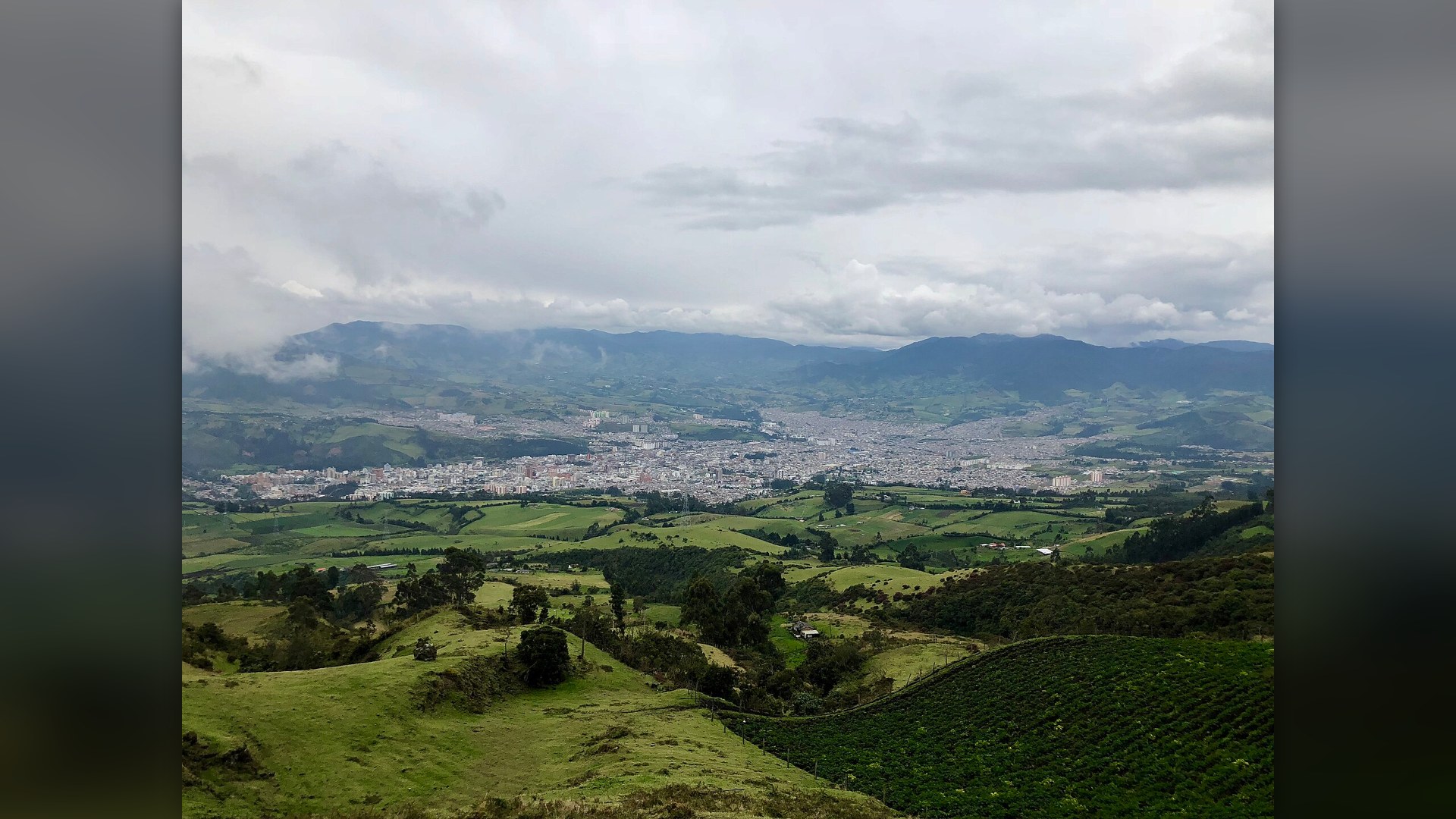
20. Pasto, Colombia
Pasto occupies the Atriz Valley at 2,527 meters elevation on the eastern flank of Galeras. Designated a Decade Volcano in the 1990s, Galeras erupted unexpectedly in January 1993, killing six scientists and three tourists inside the summit crater. Colombia's geological survey monitors it around the clock.
©Wikimedia / IShosholoza
Advertisement
Swipe or tap ▶ to resume the countdown.
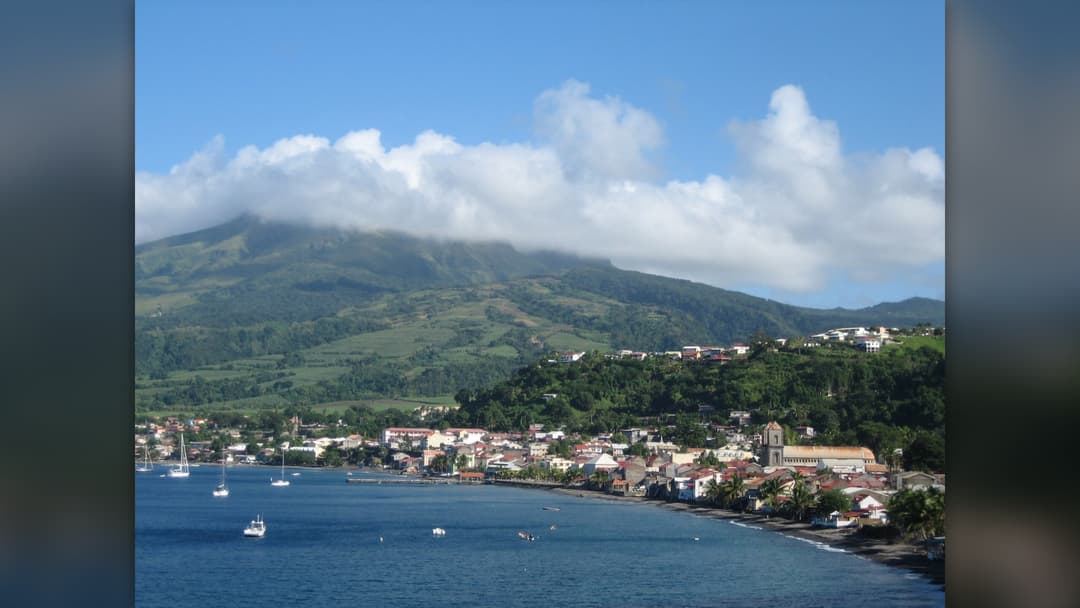
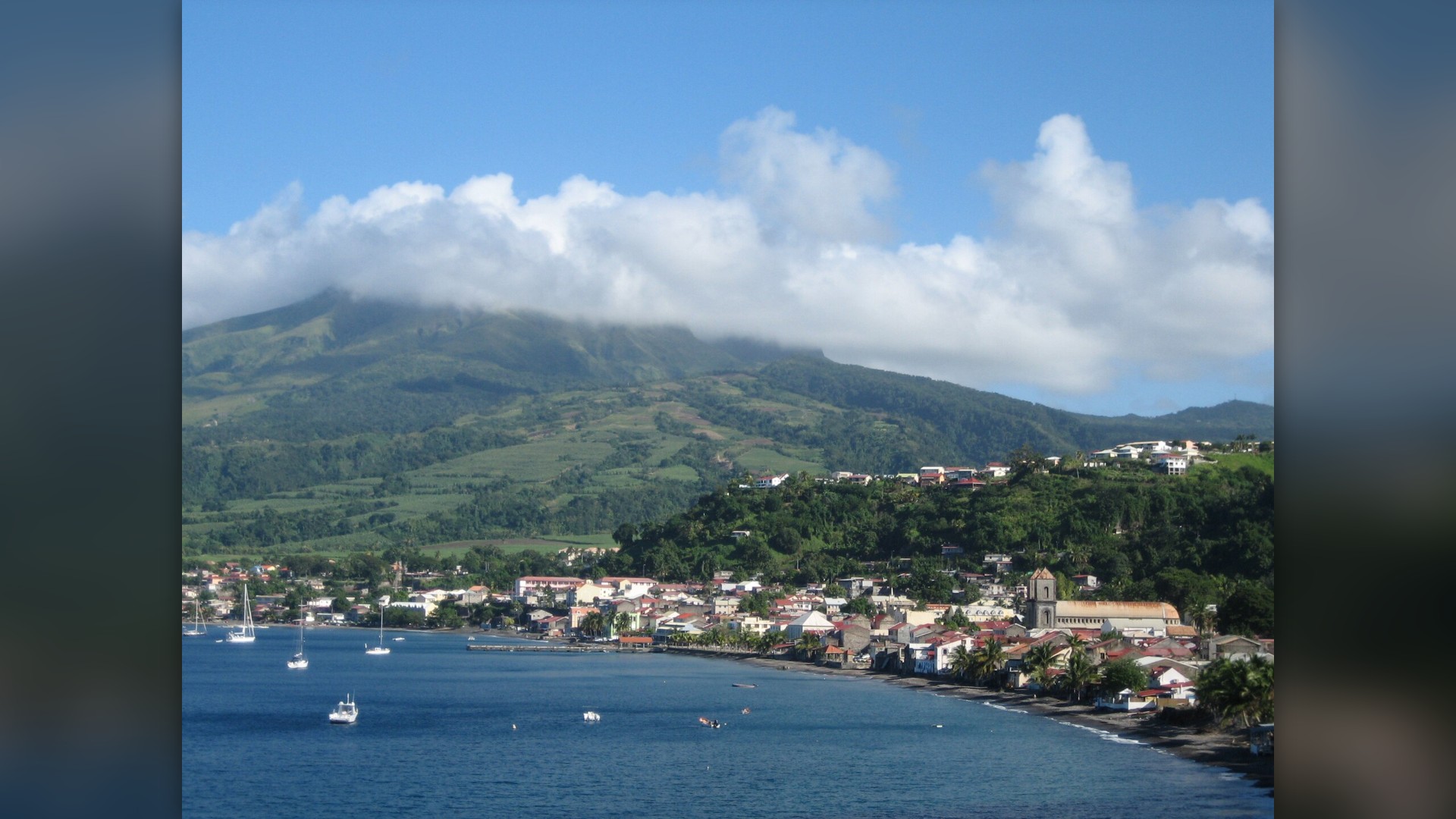
19. Saint-Pierre, Martinique
Before 1902, Saint-Pierre was Martinique's commercial hub on the northern coast below Mount Pelee. On May 8, 1902, a scorching pyroclastic surge raced down the slope in minutes, destroying the town and killing roughly 28,000 to 30,000 residents. Today a smaller town stands beside the preserved ruins.
©Wikimedia / Saint-Pierre, Martinique
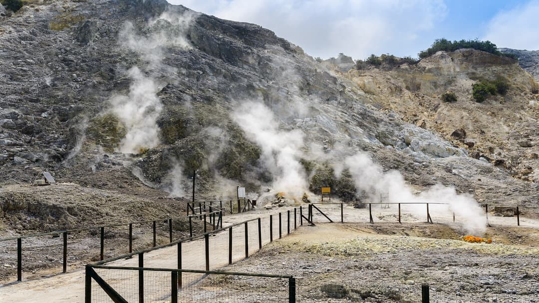
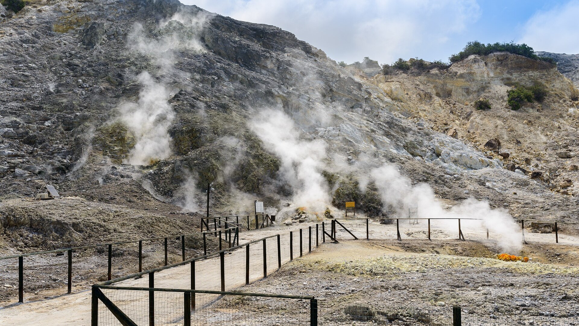
18. Pozzuoli, Italy
Pozzuoli sits near the center of Campi Flegrei, an active caldera west of Naples dotted with steaming fumaroles like Solfatara. Slow ground movement called bradyseism has lifted and sunk the harbor for centuries, leaving marine mollusk marks high on Roman columns at the ancient Macellum.
©Wikimedia / Norbert Nagel
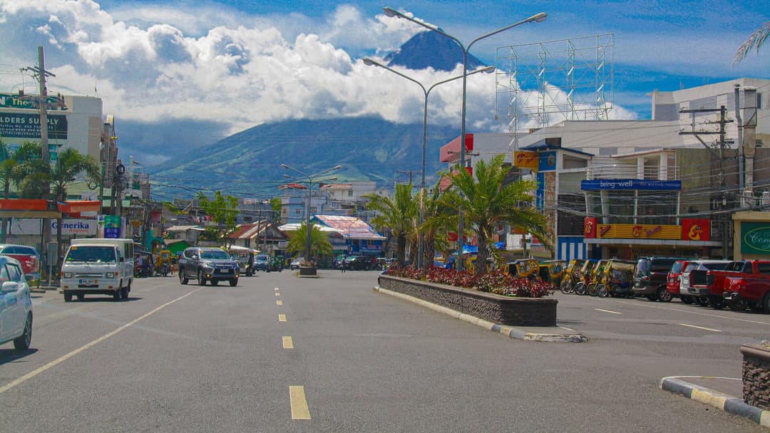
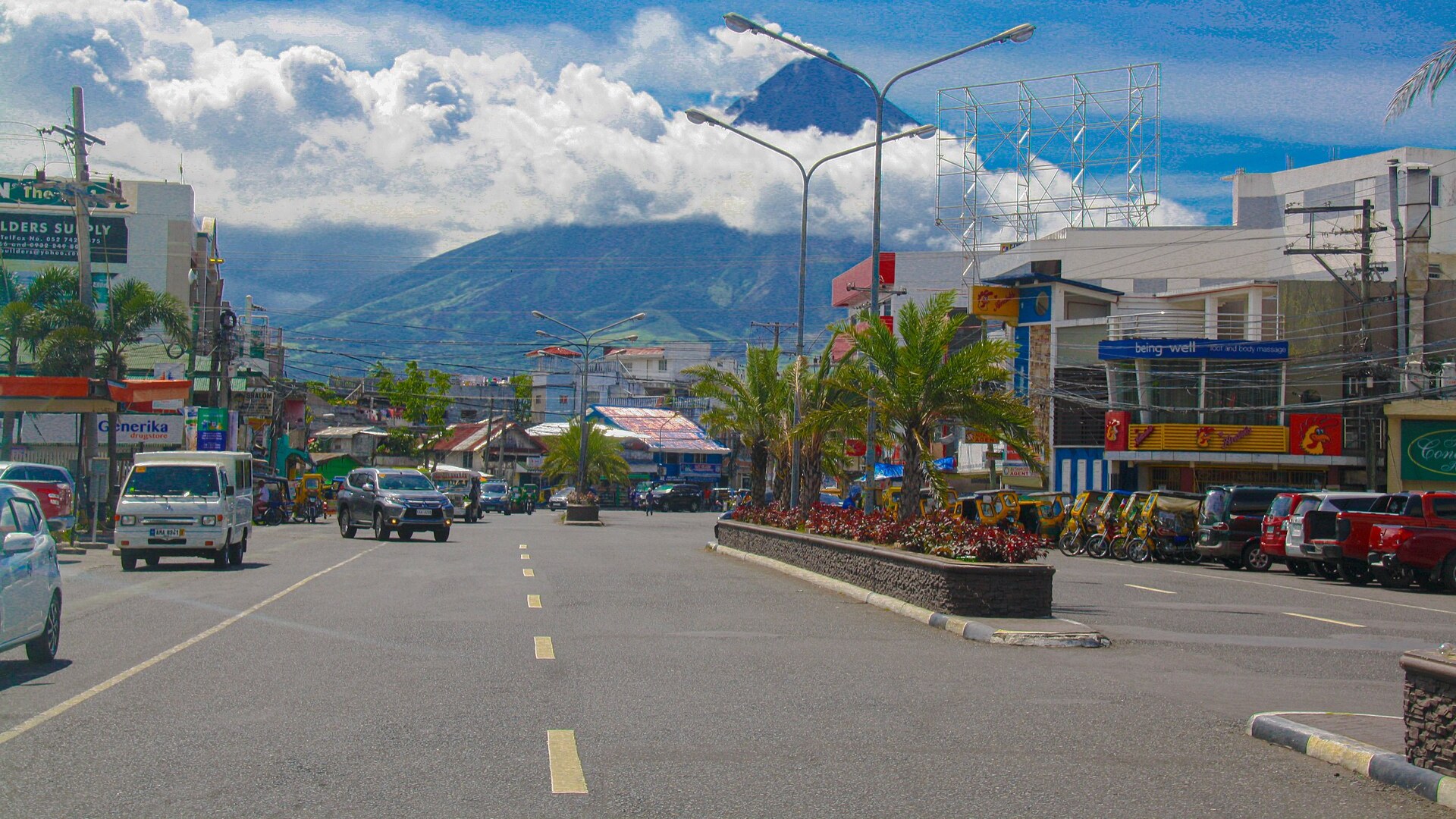
17. Legazpi, Philippines
Legazpi lies on Albay Gulf in southeastern Luzon, looking straight up at Mayon's 2,462-meter summit. Mayon's 1814 eruption buried the town of Cagsawa, leaving only a stone church belfry standing above the ash. Philippine volcanologists enforce permanent danger zones around its lower slopes.
©Wikimedia / Alcantaraeric
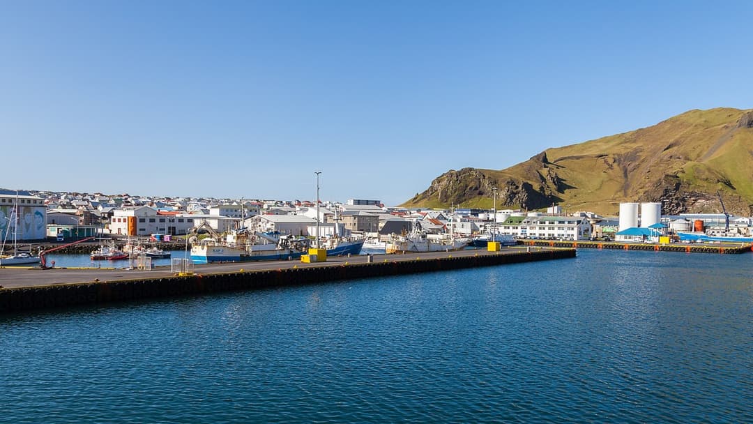
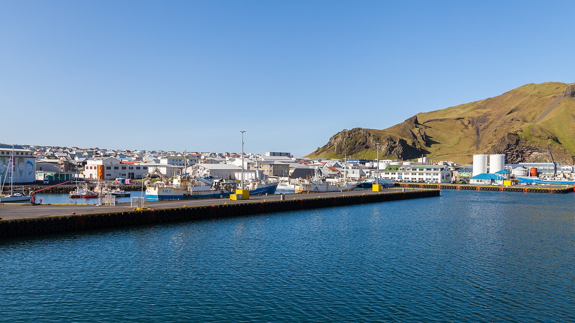
16. Vestmannaeyjar, Iceland
In January 1973, a volcanic fissure opened without warning on the edge of Vestmannaeyjar on Heimaey Island, quickly building the cone of Eldfell. Over five months, crews sprayed billions of liters of seawater to cool and divert lava away from the vital fishing port, though ash buried hundreds of homes.
©Wikimedia / Diego Delso
Advertisement
Swipe or tap ▶ to resume the countdown.
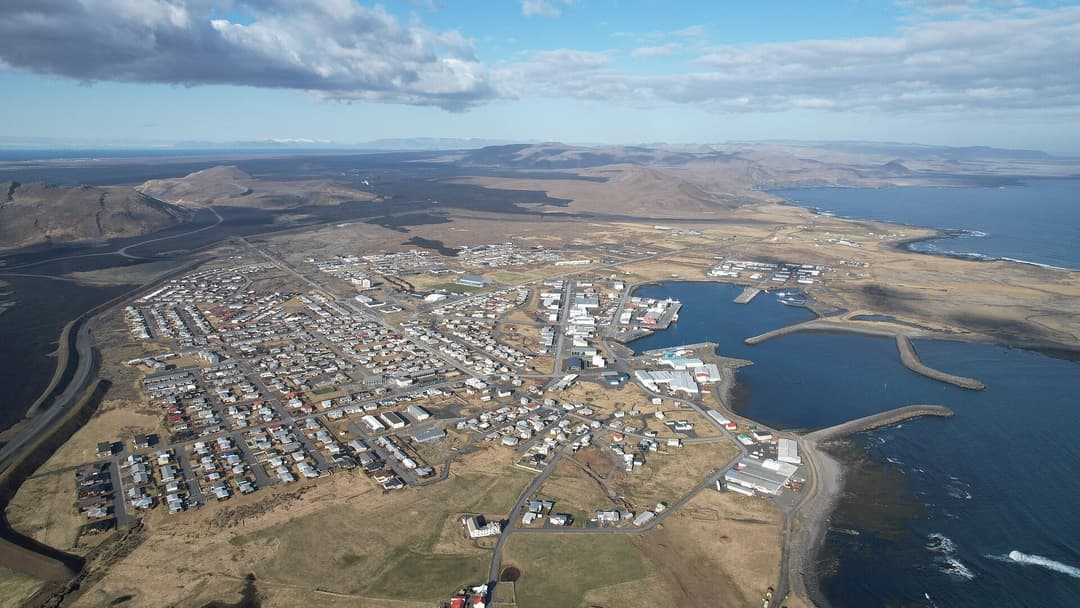
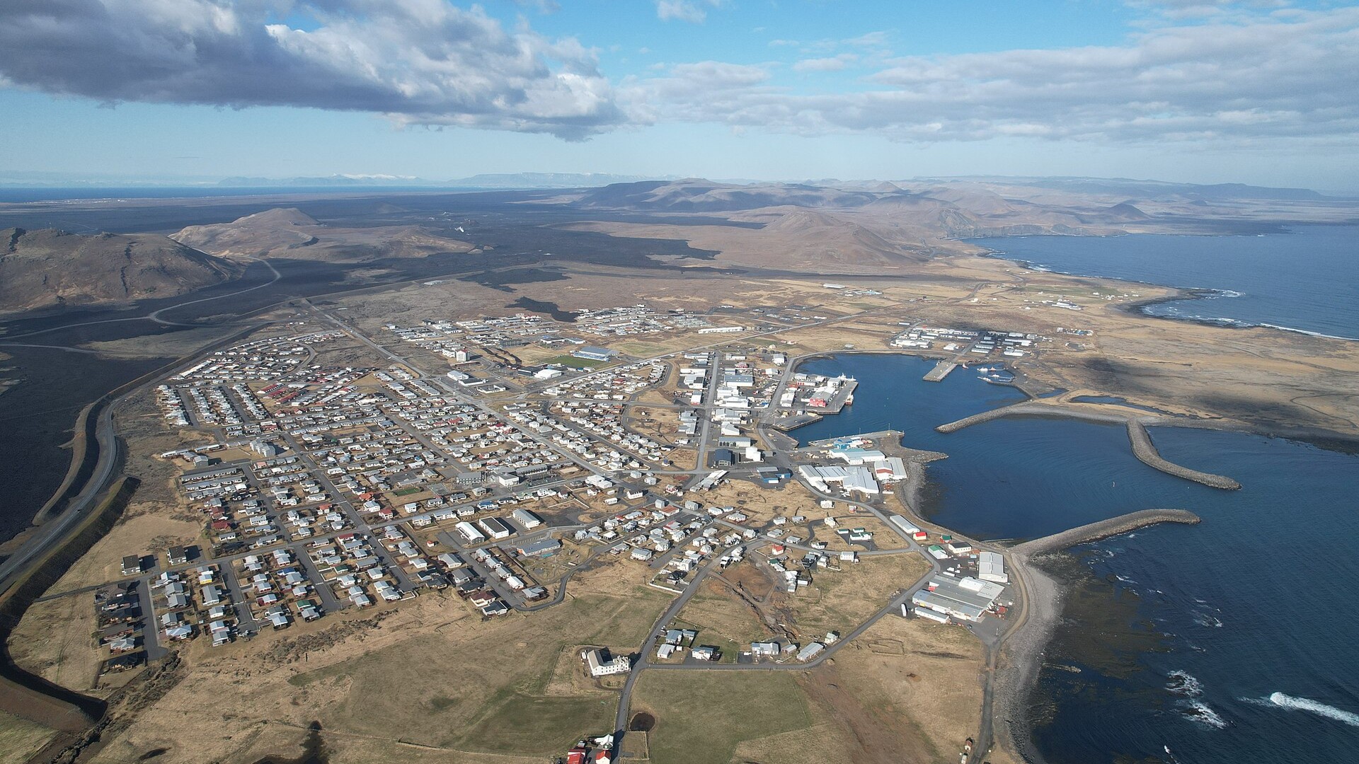
15. Grindavik, Iceland
Grindavik sits on Iceland's Reykjanes Peninsula over an active rift zone that reawakened in 2021. After intense earthquakes forced an evacuation in November 2023, repeated eruptions beginning in December 2023 breached defensive earth barriers, burned houses, and cut geothermal hot-water pipes.
©Wikimedia / Grindavík
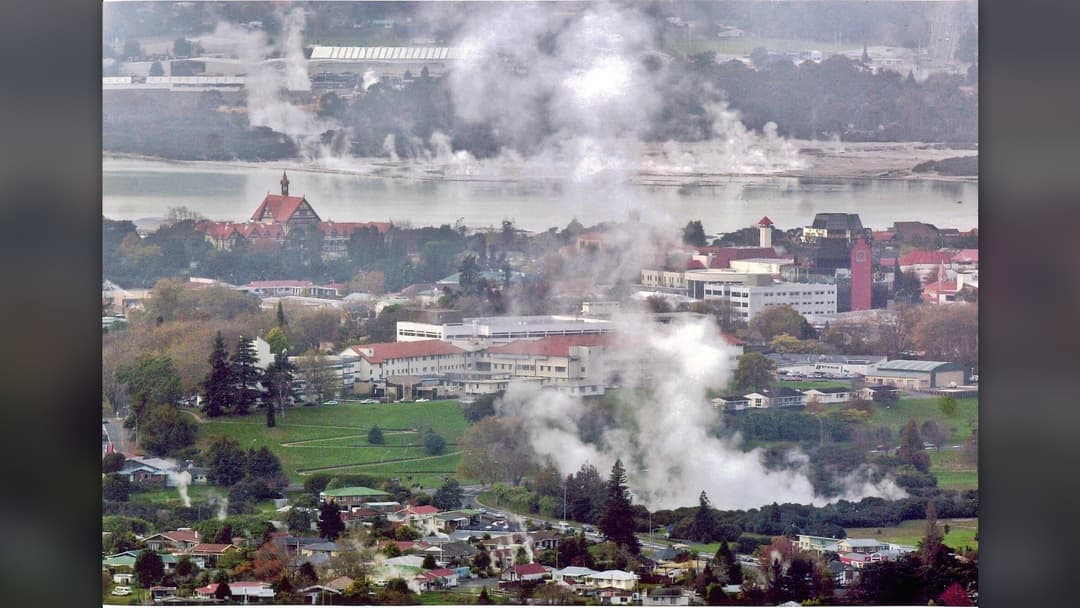
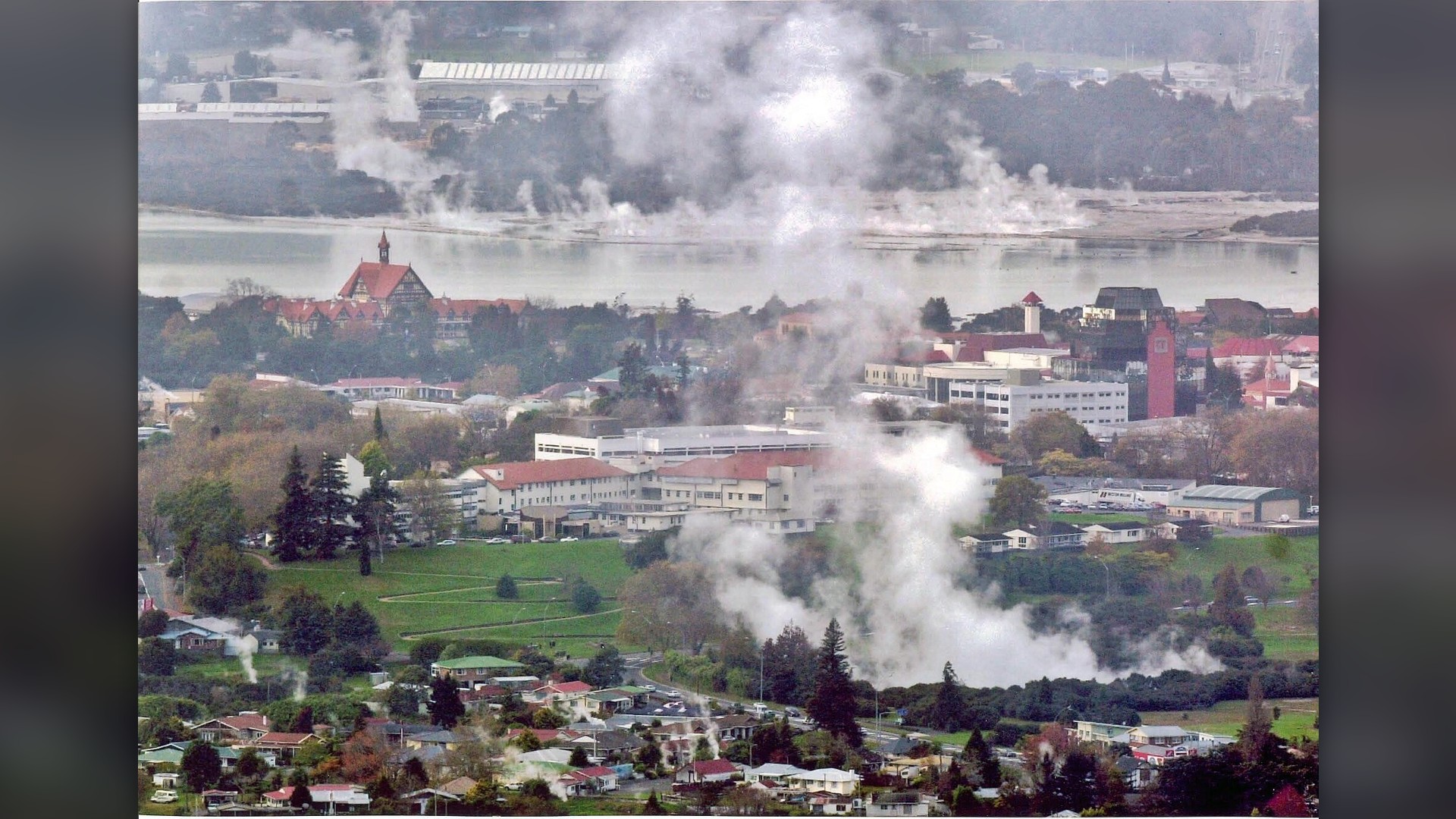
14. Rotorua, New Zealand
Rotorua was settled along Lake Rotorua inside a volcanic caldera formed roughly 240,000 years ago. Geothermal heat powers spas and warms homes while hydrogen sulfide vents hiss in public parks like Kuirau. Just 24 kilometers southeast stands Mount Tarawera, site of an explosive 1886 eruption.
©Wikimedia / Sircha at English Wikipedia
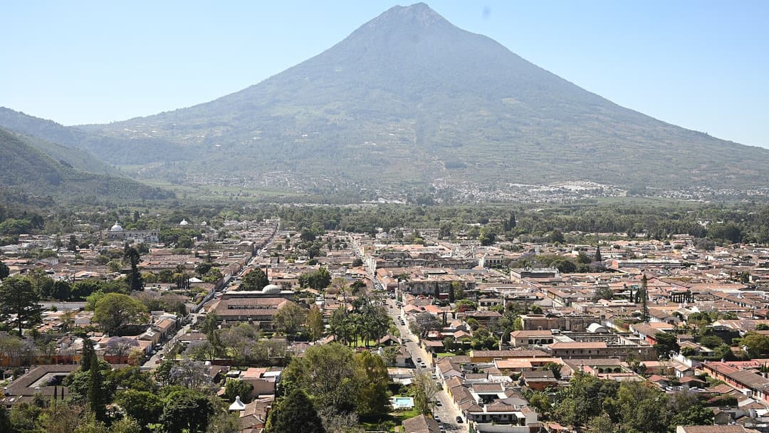
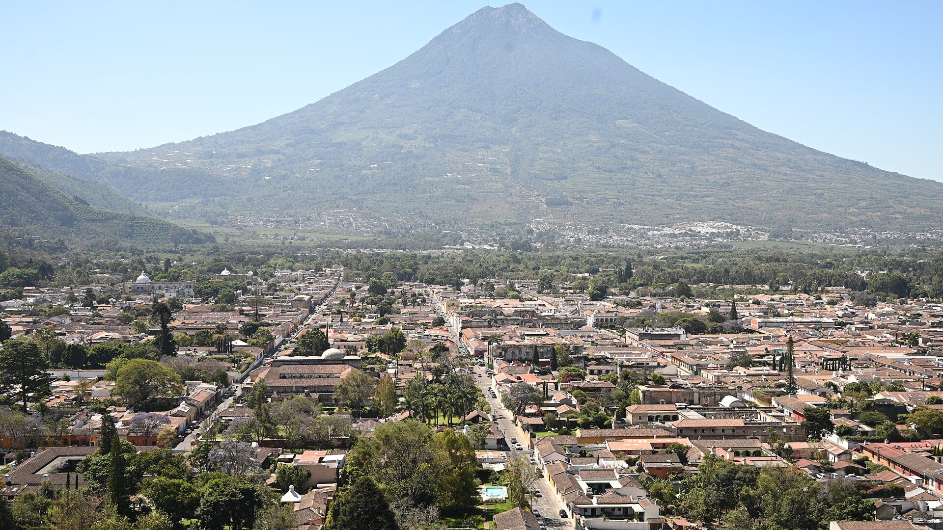
13. Antigua Guatemala, Guatemala
Founded in the Panchoy Valley after an earlier capital was ruined by mudflows from Volcan de Agua in 1541, Antigua Guatemala sits beneath Agua, Acatenango, and Fuego. Fuego stands roughly 16 kilometers southwest and erupts frequently, including a deadly June 2018 pyroclastic flow on its outer flanks.
©Wikimedia / amslerPIX
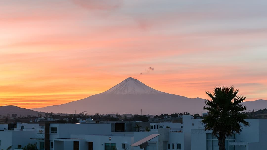
12. Puebla, Mexico
Roughly 45 kilometers east of Popocatepetl, Puebla shares a high highland basin with millions of residents across central Mexico. Popocatepetl reawakened in December 1994 after decades of quiet, producing frequent gas, ash, and glowing rock explosions tracked closely by Mexico's CENAPRED.
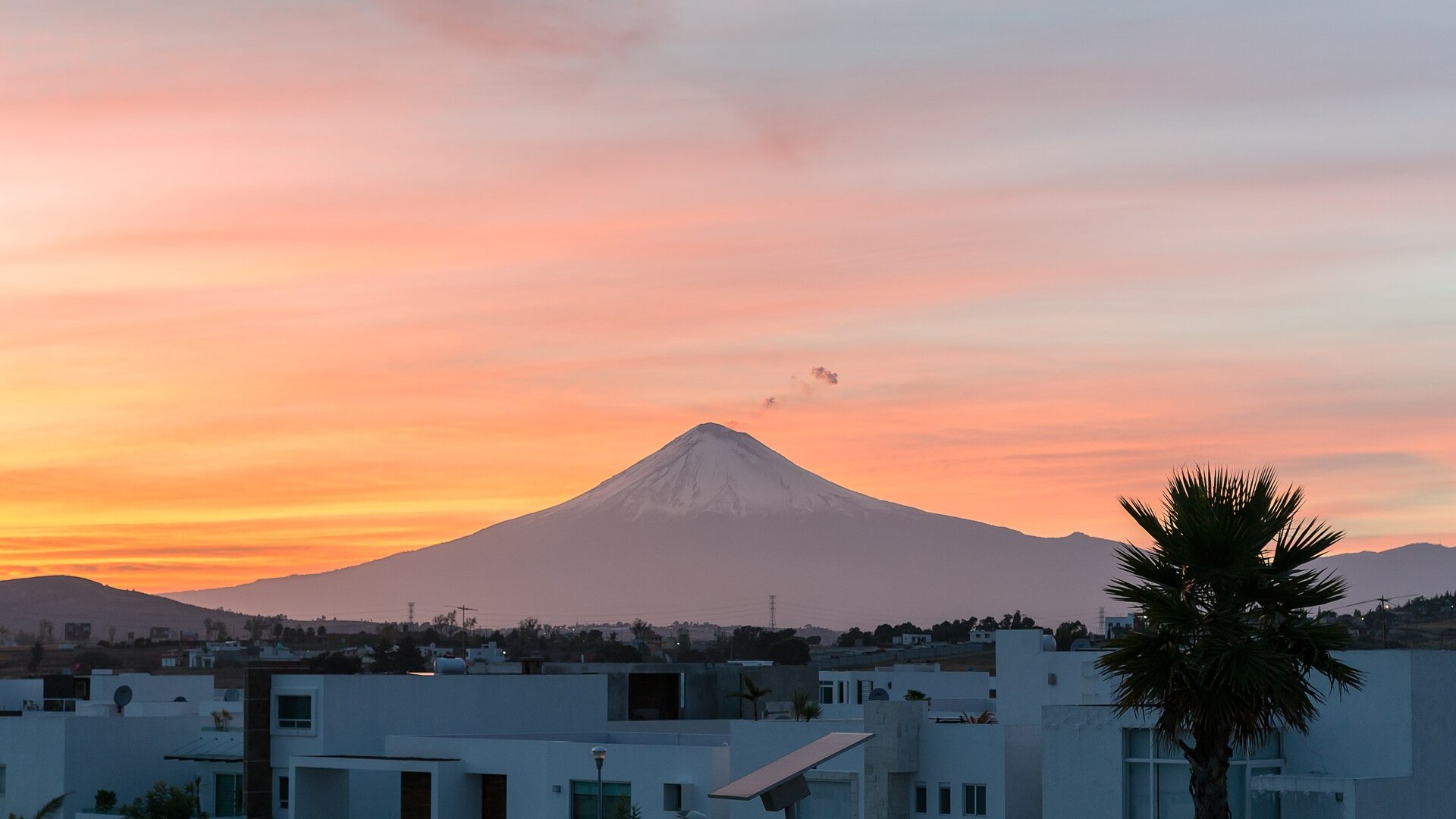
©Wikimedia / Xicotencatl
Advertisement
Swipe or tap ▶ to resume the countdown.
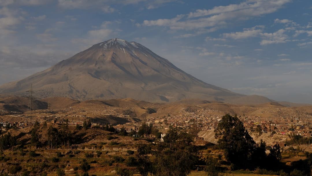
11. Arequipa, Peru
Arequipa's historic center is built from pale sillar ignimbrite, a volcanic rock laid down by ancient eruptions in southern Peru. Rising 5,822 meters just 17 kilometers northeast of the main plaza, El Misti last produced a major explosive eruption in the 1440s and remains actively monitored.
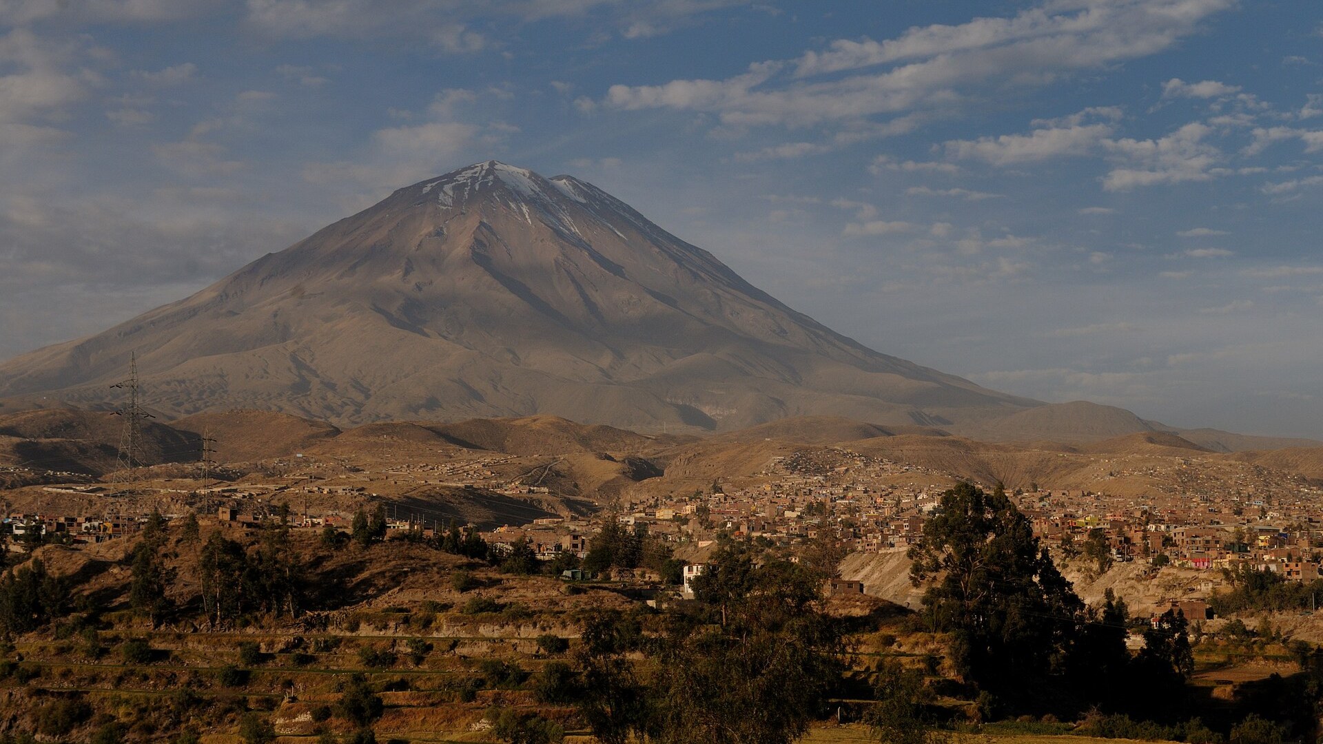
©Wikimedia / Josep M. Gracia
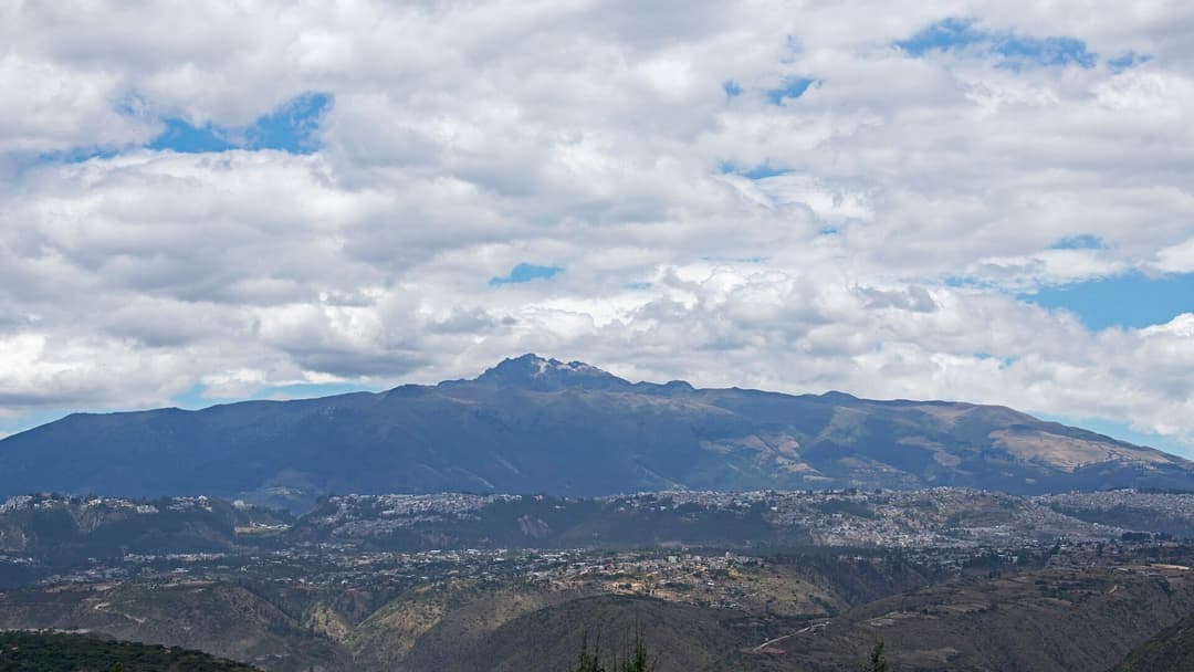
10. Quito, Ecuador
Quito stretches along a narrow Andean valley at 2,850 meters elevation right against the Pichincha volcanic massif. In October 1999, phreatic explosions from Guagua Pichincha sent a thick ash column over the capital, shutting down the airport and dusting rooftops across the entire city.
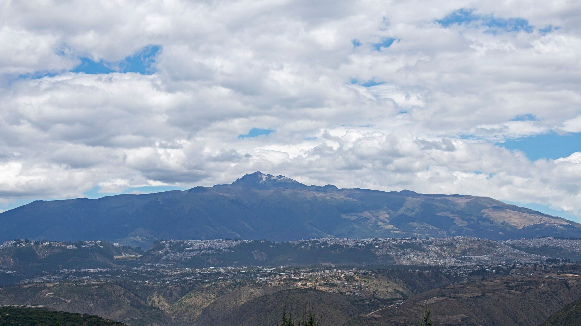
©Wikimedia / Ymblanter
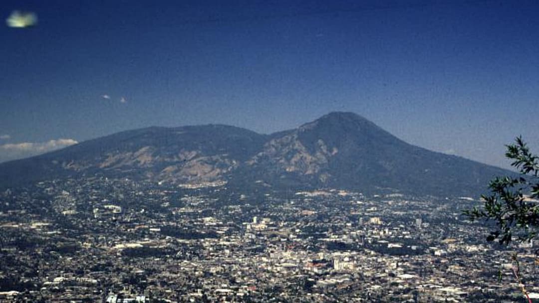
9. San Salvador, El Salvador
San Salvador sits directly southeast of the 1,893-meter San Salvador Volcano, known locally as Quezaltepeque. In June 1917, a flank eruption poured lava down the northern side toward Quezaltepeque while earthquakes wrecked parts of the capital and drained a crater lake inside El Boqueron.
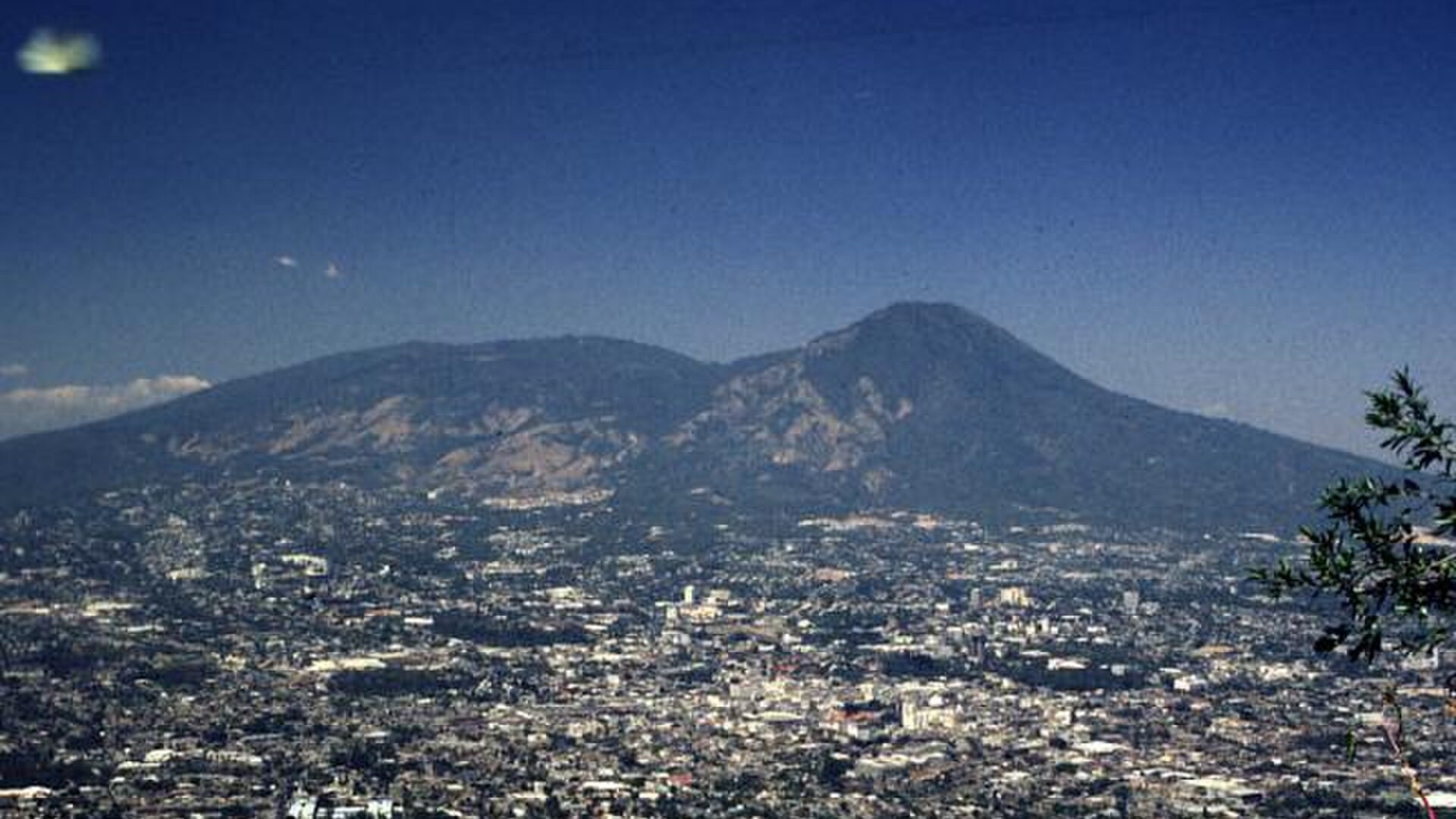
©Wikimedia / Rick Wunderman, Smithsonian Institution
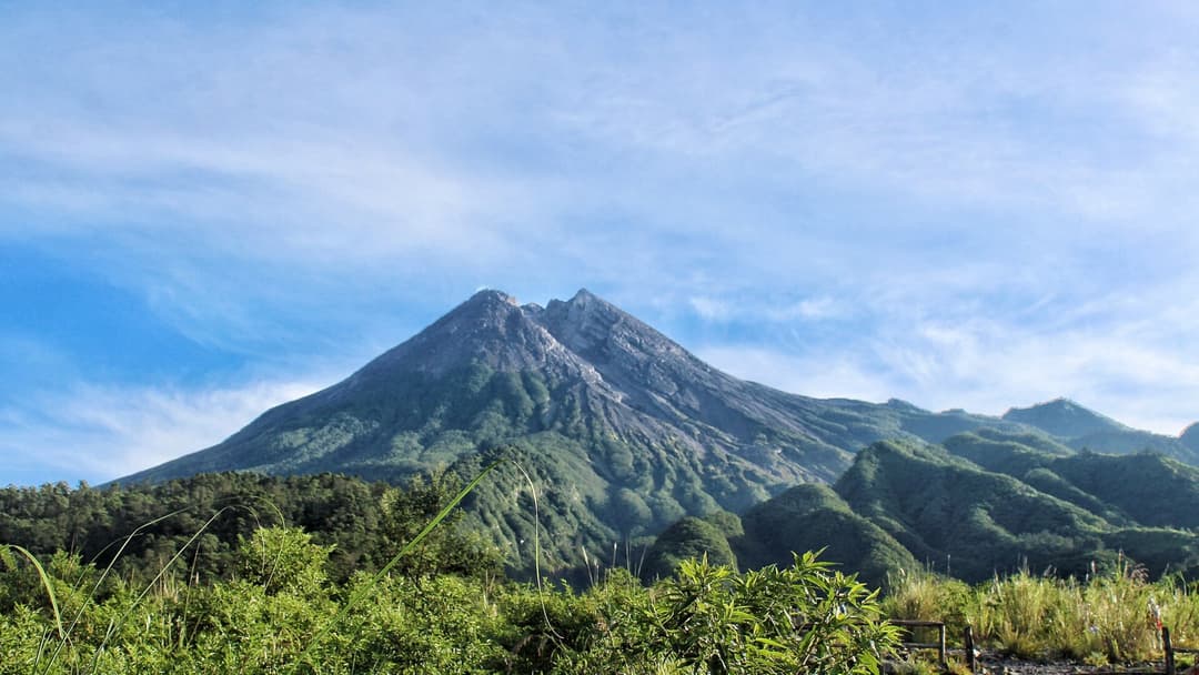
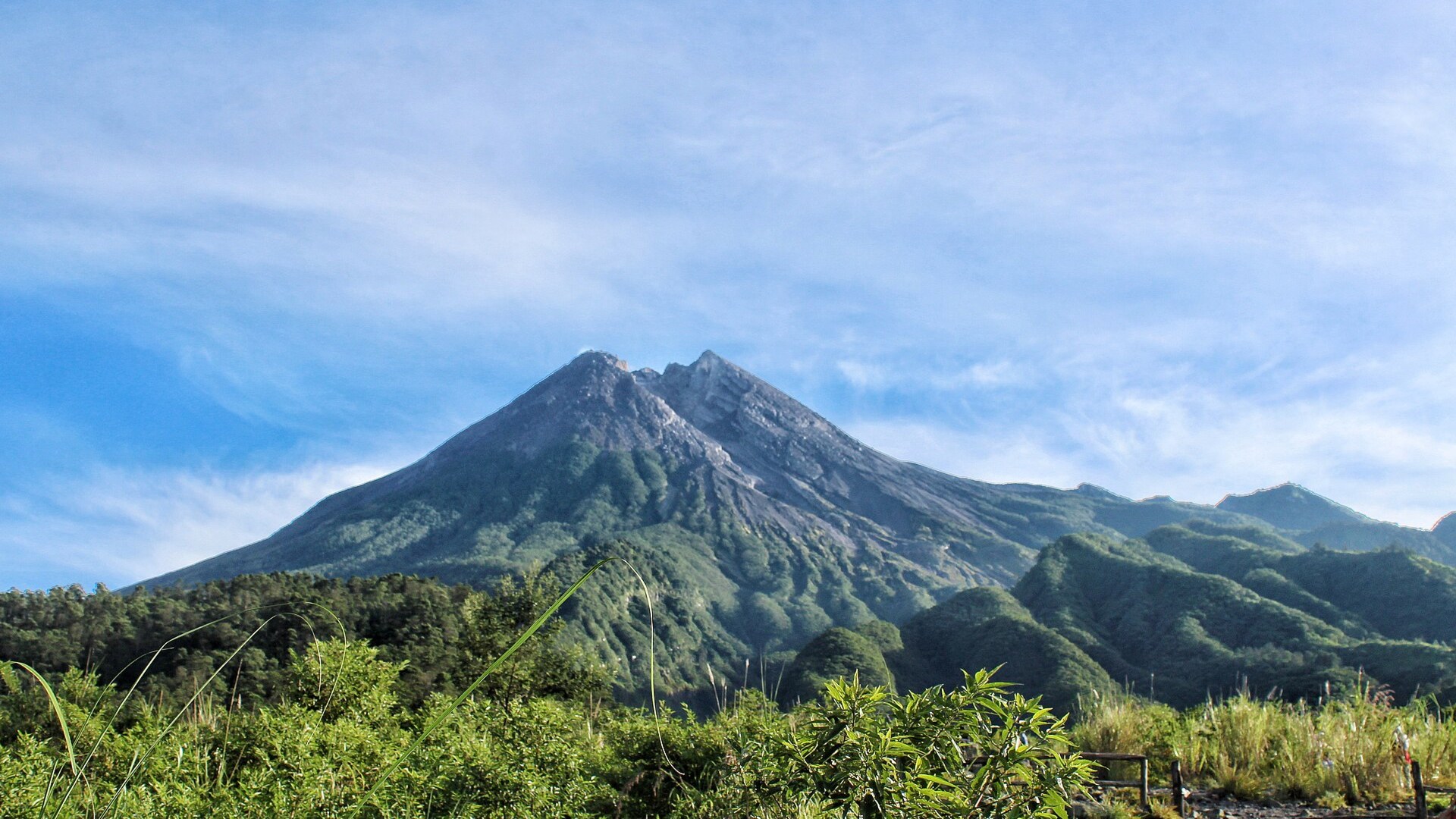
8. Yogyakarta, Indonesia
Located roughly 30 kilometers south of Mount Merapi's summit, Yogyakarta faces frequent ashfalls and volcanic mudflows channeled down river valleys. Merapi's 2010 eruption displaced more than 350,000 people and sent pyroclastic surges far down its slopes, reshaping hazard maps across Java.
©Wikimedia / Rosalia.silaban
Advertisement
Swipe or tap ▶ to resume the countdown.
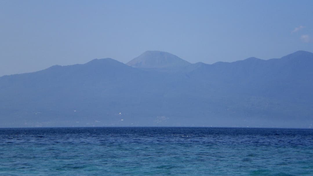
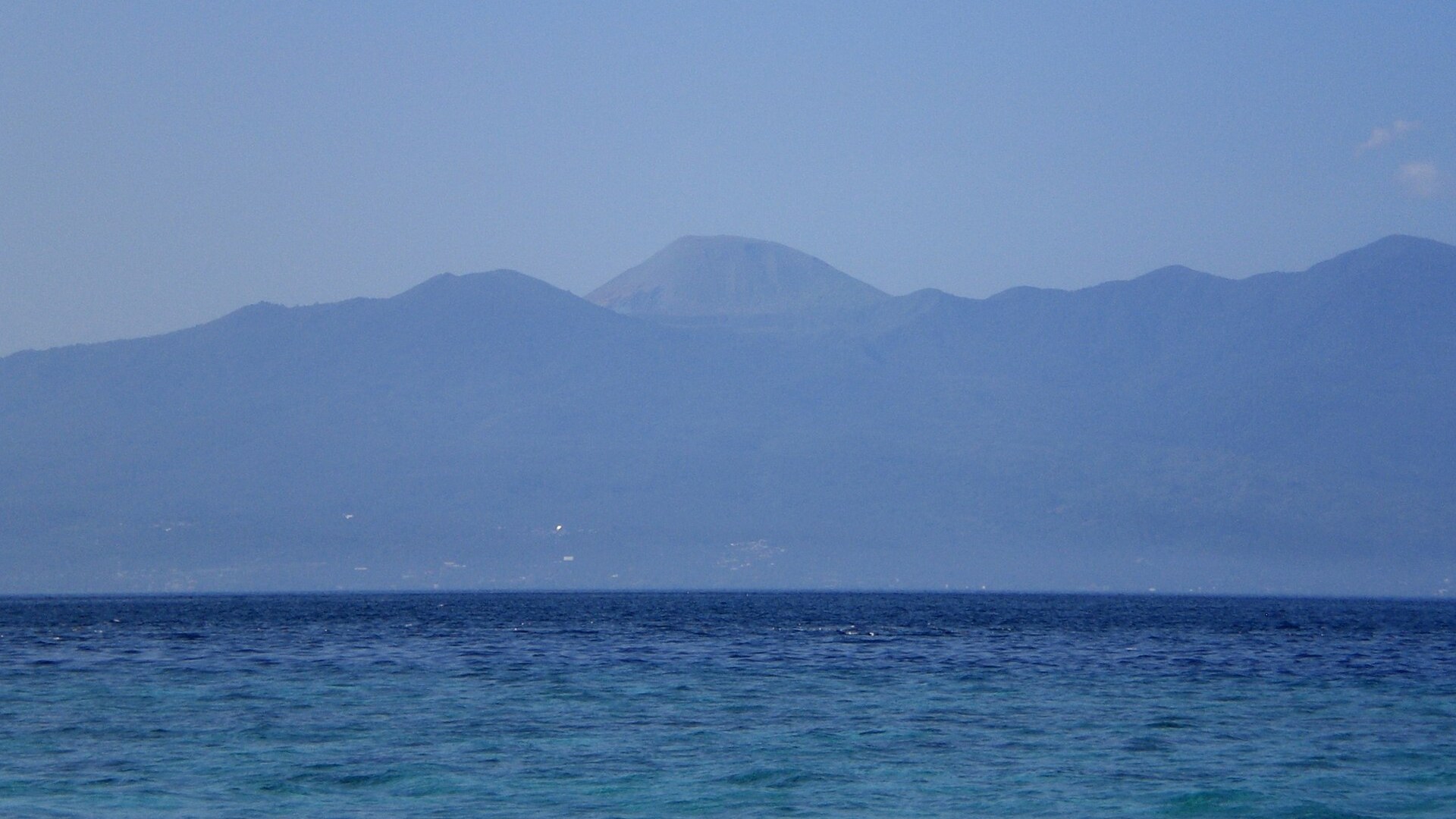
7. Manado, Indonesia
Manado sits on the northern tip of Sulawesi along a bay flanked by active cones of the Sangihe volcanic arc. Mount Lokon-Empung rises only about 10 kilometers south of the city, and its July 2011 explosive eruptions forced thousands of nearby villagers into temporary shelters.
©Wikimedia / Lofor
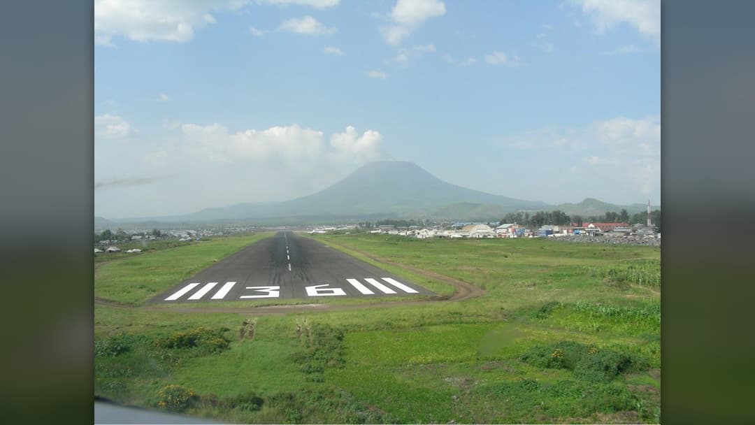
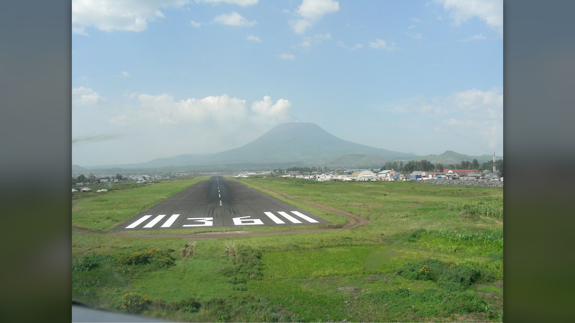
6. Goma, DR Congo
Mount Nyiragongo holds one of the world's largest persistent lava lakes, and its runny basaltic lava moves at high speed. Eruptions in 1977, January 2002, and May 2021 sent lava rivers straight into Goma, destroying neighborhoods, cutting parts of the airport runway, and forcing mass evacuations.
©Wikimedia / Alexei Shevelev
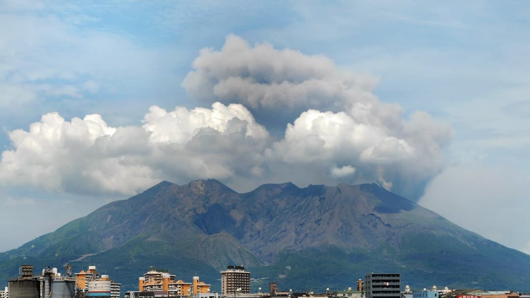
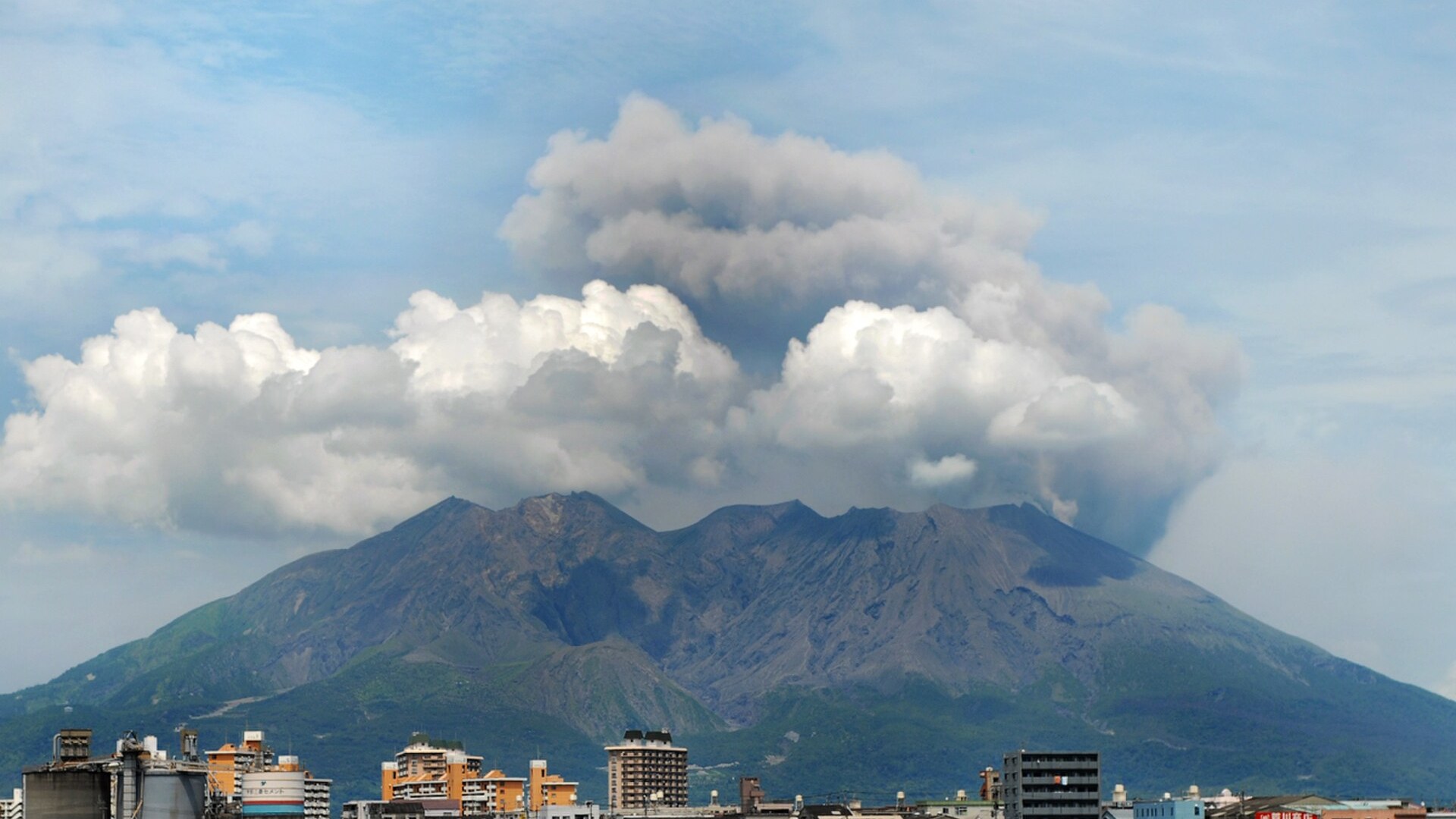
5. Kagoshima, Japan
Kagoshima residents carry umbrellas for falling ash and sweep volcanic dust into municipal collection bags. In 1914, Sakurajima's massive eruption poured so much lava into the sea that the former island fused permanently to the Osumi Peninsula, while modern blasts still light up the bay.
©Wikimedia / Mstyslav Chernov/Unframe/www.unframe.com
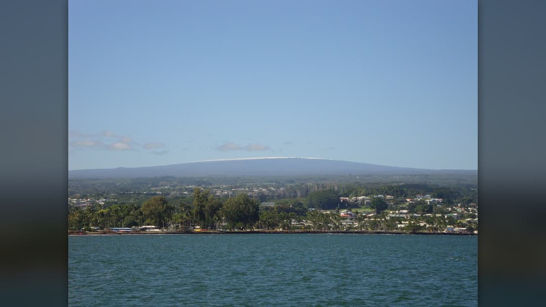
4. Hilo, Hawaii
Hilo sits directly downslope from Mauna Loa's Northeast Rift Zone on Hawaii Island. Lava flows in 1880 and 1881 reached the outskirts of town, and a three-week eruption in 1984 pushed an active flow within 6.5 kilometers of Hilo before stopping. USGS monitors every swell on the mountain.
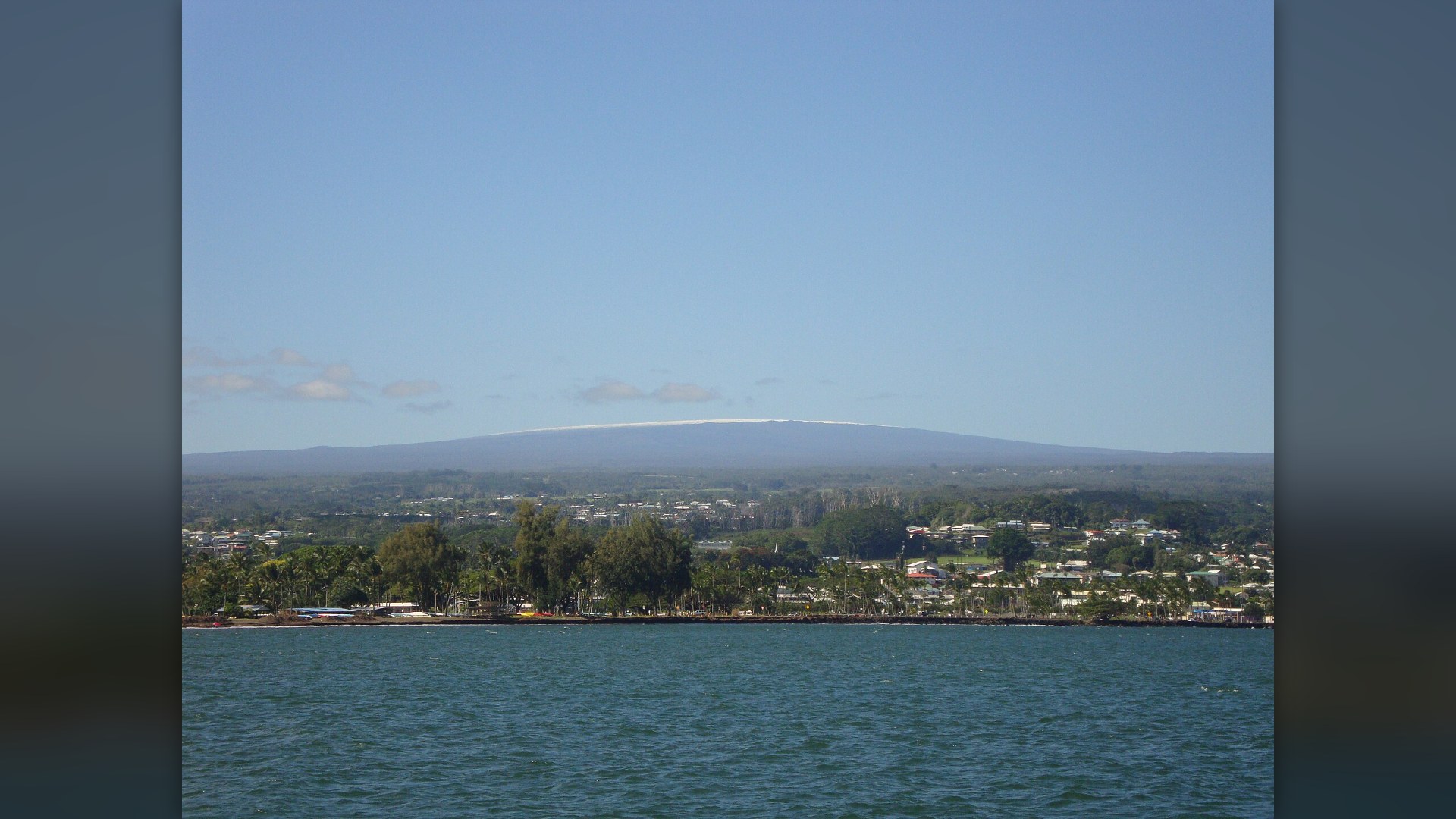
©Wikimedia / Kaleodu
Advertisement
Swipe or tap ▶ to resume the countdown.
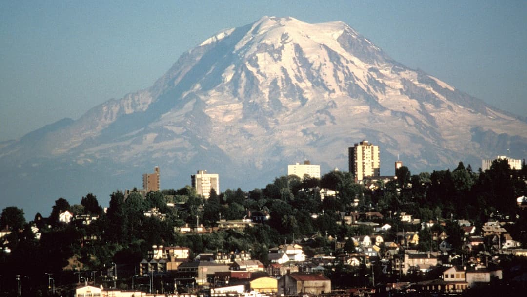
3. Tacoma, Washington
Rising 4,392 meters above Puget Sound, glacier-clad Mount Rainier ranks among the highest-threat volcanoes in the United States. About 5,600 years ago, the Osceola Mudflow sent lahar debris from its summit all the way to Tacoma's port flats, prompting modern siren warning networks in the valley.
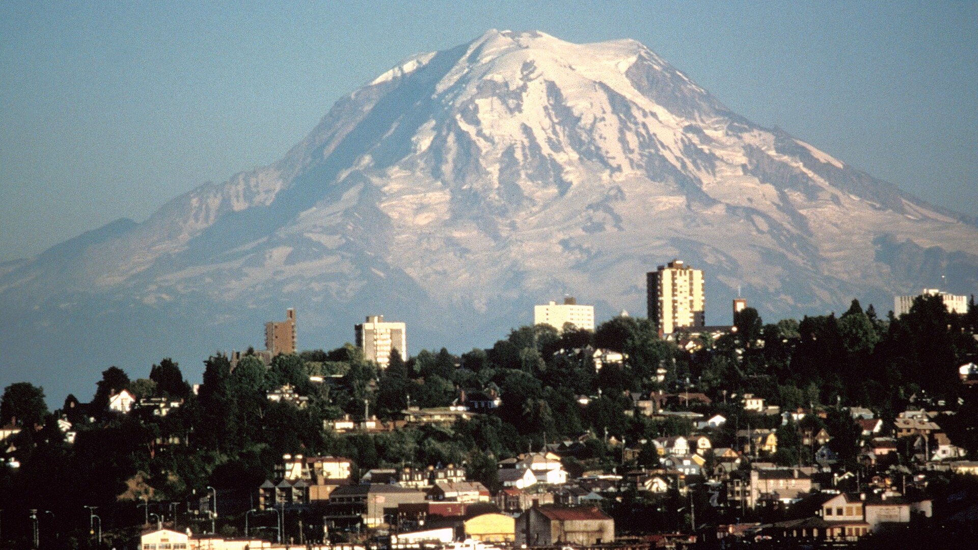
©Wikimedia / Lyn Topinka (USGS)
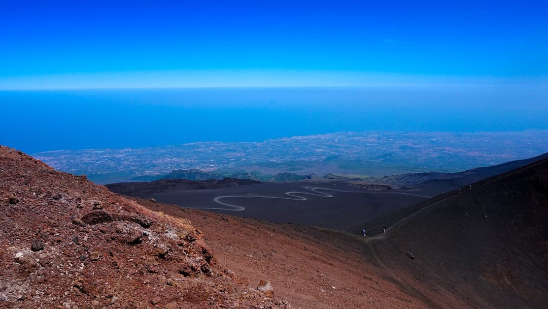
2. Catania, Italy
Mount Etna looms directly above Catania on Sicily's eastern coast and erupts almost every year. In 1669, a flank eruption poured lava over Catania's western walls, buried streets, surrounded Ursino Castle, and reached the Ionian Sea. Today black lava stone shapes the city's Baroque squares.
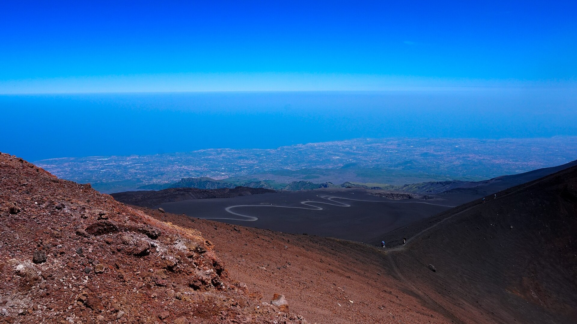
©Wikimedia / lewispb
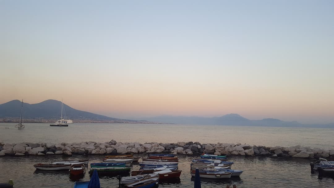
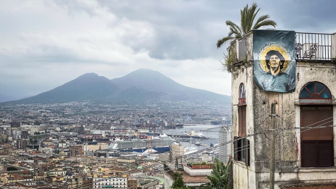
1. Naples, Italy
Mount Vesuvius dominates the Bay of Naples just kilometers from dense coastal towns like Portici, Ercolano, and Torre del Greco. Famous for burying Pompeii and Herculaneum in 79 AD, Vesuvius last erupted in March 1944 during World War II. Italy's civil protection agency maintains strict evacuation plans.
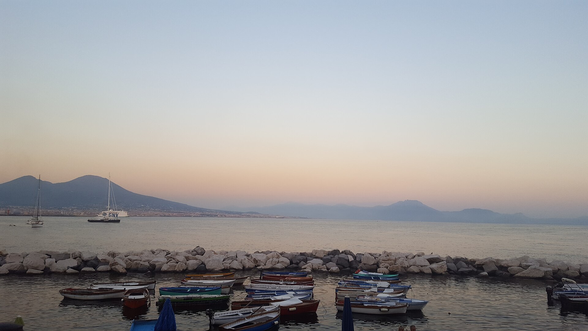
©Wikimedia / H.A.W.C 101
Advertisement
You've reached the end of the story. Thanks for reading!

25 Most Welcoming US States Ranked by Hospitality
Which American State Truly Treats Strangers Like Family
All 22 Entries in this Story
22. Rabaul, Papua New Guinea
Rabaul was built inside a flooded volcanic caldera on New Britain Island. On September 19, 1994, vents Tavurvur and Vulcan erupted together, collapsing roofs across the town under wet ash. Papua New Guinea moved the provincial capital to Kokopo, though Rabaul's deep harbor remains active.

21. Shimabara, Japan
Shimabara sits on Kyushu's Shimabara Peninsula directly below the Mount Unzen volcanic complex. In 1792, an eruption and collapse of Mount Mayuyama triggered a deadly tsunami across the Ariake Sea. After June 1991 pyroclastic flows killed 43 people, engineers built check dams and evacuation channels.

20. Pasto, Colombia
Pasto occupies the Atriz Valley at 2,527 meters elevation on the eastern flank of Galeras. Designated a Decade Volcano in the 1990s, Galeras erupted unexpectedly in January 1993, killing six scientists and three tourists inside the summit crater. Colombia's geological survey monitors it around the clock.

19. Saint-Pierre, Martinique
Before 1902, Saint-Pierre was Martinique's commercial hub on the northern coast below Mount Pelee. On May 8, 1902, a scorching pyroclastic surge raced down the slope in minutes, destroying the town and killing roughly 28,000 to 30,000 residents. Today a smaller town stands beside the preserved ruins.

18. Pozzuoli, Italy
Pozzuoli sits near the center of Campi Flegrei, an active caldera west of Naples dotted with steaming fumaroles like Solfatara. Slow ground movement called bradyseism has lifted and sunk the harbor for centuries, leaving marine mollusk marks high on Roman columns at the ancient Macellum.

17. Legazpi, Philippines
Legazpi lies on Albay Gulf in southeastern Luzon, looking straight up at Mayon's 2,462-meter summit. Mayon's 1814 eruption buried the town of Cagsawa, leaving only a stone church belfry standing above the ash. Philippine volcanologists enforce permanent danger zones around its lower slopes.

16. Vestmannaeyjar, Iceland
In January 1973, a volcanic fissure opened without warning on the edge of Vestmannaeyjar on Heimaey Island, quickly building the cone of Eldfell. Over five months, crews sprayed billions of liters of seawater to cool and divert lava away from the vital fishing port, though ash buried hundreds of homes.

15. Grindavik, Iceland
Grindavik sits on Iceland's Reykjanes Peninsula over an active rift zone that reawakened in 2021. After intense earthquakes forced an evacuation in November 2023, repeated eruptions beginning in December 2023 breached defensive earth barriers, burned houses, and cut geothermal hot-water pipes.

14. Rotorua, New Zealand
Rotorua was settled along Lake Rotorua inside a volcanic caldera formed roughly 240,000 years ago. Geothermal heat powers spas and warms homes while hydrogen sulfide vents hiss in public parks like Kuirau. Just 24 kilometers southeast stands Mount Tarawera, site of an explosive 1886 eruption.

13. Antigua Guatemala, Guatemala
Founded in the Panchoy Valley after an earlier capital was ruined by mudflows from Volcan de Agua in 1541, Antigua Guatemala sits beneath Agua, Acatenango, and Fuego. Fuego stands roughly 16 kilometers southwest and erupts frequently, including a deadly June 2018 pyroclastic flow on its outer flanks.

12. Puebla, Mexico
Roughly 45 kilometers east of Popocatepetl, Puebla shares a high highland basin with millions of residents across central Mexico. Popocatepetl reawakened in December 1994 after decades of quiet, producing frequent gas, ash, and glowing rock explosions tracked closely by Mexico's CENAPRED.

11. Arequipa, Peru
Arequipa's historic center is built from pale sillar ignimbrite, a volcanic rock laid down by ancient eruptions in southern Peru. Rising 5,822 meters just 17 kilometers northeast of the main plaza, El Misti last produced a major explosive eruption in the 1440s and remains actively monitored.

10. Quito, Ecuador
Quito stretches along a narrow Andean valley at 2,850 meters elevation right against the Pichincha volcanic massif. In October 1999, phreatic explosions from Guagua Pichincha sent a thick ash column over the capital, shutting down the airport and dusting rooftops across the entire city.

9. San Salvador, El Salvador
San Salvador sits directly southeast of the 1,893-meter San Salvador Volcano, known locally as Quezaltepeque. In June 1917, a flank eruption poured lava down the northern side toward Quezaltepeque while earthquakes wrecked parts of the capital and drained a crater lake inside El Boqueron.

8. Yogyakarta, Indonesia
Located roughly 30 kilometers south of Mount Merapi's summit, Yogyakarta faces frequent ashfalls and volcanic mudflows channeled down river valleys. Merapi's 2010 eruption displaced more than 350,000 people and sent pyroclastic surges far down its slopes, reshaping hazard maps across Java.

7. Manado, Indonesia
Manado sits on the northern tip of Sulawesi along a bay flanked by active cones of the Sangihe volcanic arc. Mount Lokon-Empung rises only about 10 kilometers south of the city, and its July 2011 explosive eruptions forced thousands of nearby villagers into temporary shelters.

6. Goma, DR Congo
Mount Nyiragongo holds one of the world's largest persistent lava lakes, and its runny basaltic lava moves at high speed. Eruptions in 1977, January 2002, and May 2021 sent lava rivers straight into Goma, destroying neighborhoods, cutting parts of the airport runway, and forcing mass evacuations.

5. Kagoshima, Japan
Kagoshima residents carry umbrellas for falling ash and sweep volcanic dust into municipal collection bags. In 1914, Sakurajima's massive eruption poured so much lava into the sea that the former island fused permanently to the Osumi Peninsula, while modern blasts still light up the bay.

4. Hilo, Hawaii
Hilo sits directly downslope from Mauna Loa's Northeast Rift Zone on Hawaii Island. Lava flows in 1880 and 1881 reached the outskirts of town, and a three-week eruption in 1984 pushed an active flow within 6.5 kilometers of Hilo before stopping. USGS monitors every swell on the mountain.

3. Tacoma, Washington
Rising 4,392 meters above Puget Sound, glacier-clad Mount Rainier ranks among the highest-threat volcanoes in the United States. About 5,600 years ago, the Osceola Mudflow sent lahar debris from its summit all the way to Tacoma's port flats, prompting modern siren warning networks in the valley.

2. Catania, Italy
Mount Etna looms directly above Catania on Sicily's eastern coast and erupts almost every year. In 1669, a flank eruption poured lava over Catania's western walls, buried streets, surrounded Ursino Castle, and reached the Ionian Sea. Today black lava stone shapes the city's Baroque squares.

1. Naples, Italy
Mount Vesuvius dominates the Bay of Naples just kilometers from dense coastal towns like Portici, Ercolano, and Torre del Greco. Famous for burying Pompeii and Herculaneum in 79 AD, Vesuvius last erupted in March 1944 during World War II. Italy's civil protection agency maintains strict evacuation plans.